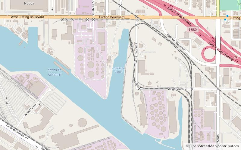
Lauritzen Canal, Richmond
Map
Facts and practical information
The Lauritzen Canal is a shipping waterway which is part of the larger Port of Richmond in Richmond, California. It was dredged out of the former expanse of the now atrophied Castro Cove wetlands of the West Richmond Watershed. It was created for shipbuilding yards in World War II. Today is serves as part of the operation of the Port of Richmond for largely petrochemical, liquid bulk, and vehicle imports. ()
Coordinates: 37°55'19"N, 122°22'1"W
Address
Richmond
ContactAdd
Social media
Add
Getting there by public transportation
Public transportation stops near this location
- Metro
- Bus
- Train
 Metro
Metro
- Calculate routeCutting Boulevard & Harbour Way South 12 min walk
- Calculate routeHarbour Way South & Maine Avenue 15 min walk
- Calculate routeMarina Way South & Regatta Boulevard 18 min walk
- Calculate routeRichmond 33 min walk
- Calculate routeRichmond 33 min walk
Day trips


Frequently Asked Questions (FAQ)
Which popular attractions are close to Lauritzen Canal?
Nearby attractions include Port of Richmond, Richmond (15 min walk), Atchison Village, Richmond (22 min walk).
How to get to Lauritzen Canal by public transport?
The nearest stations to Lauritzen Canal:
Bus
Train
Metro
Bus
- Cutting Boulevard & Harbour Way South • Lines: 40, 40X, 76 (12 min walk)
- Harbour Way South & Maine Avenue • Lines: 76 (15 min walk)
Train
- Richmond (33 min walk)
Metro
- Richmond • Lines: Orange, Red (33 min walk)