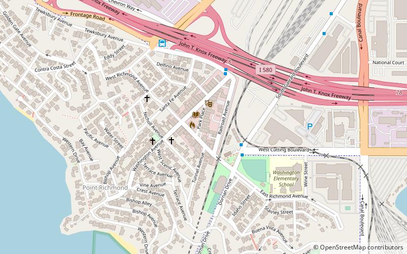
Point Richmond Historic District, Richmond

Gallery (1)
Map
Map
Facts and practical information
The Point Richmond Historic District is the downtown area of Point Richmond in Richmond, California, and is on the National Register of Historic Places. ()
Built: 1905 (121 years ago)Coordinates: 37°55'34"N, 122°23'6"W
Address
Point RichmondRichmond
ContactAdd
Social media
Add
Getting there by public transportation
Public transportation stops near this location
- Bus
 Bus
Bus
- Calculate routeSouth Garrard Boulevard & West Cutting Boulevard 3 min walk
- Calculate routeTewksbury Turnaround 6 min walk
- Calculate routeTewksbury Avenue & Castro Street 6 min walk
Day trips


Frequently Asked Questions (FAQ)
Which popular attractions are close to Point Richmond Historic District?
Nearby attractions include The Masquers Playhouse, Richmond (2 min walk), The Plunge, Richmond (4 min walk), Point Richmond, Richmond (7 min walk), Keller Beach, Richmond (10 min walk).
How to get to Point Richmond Historic District by public transport?
The nearest stations to Point Richmond Historic District:
Bus
Bus
- South Garrard Boulevard & West Cutting Boulevard • Lines: 72M (3 min walk)
- Tewksbury Turnaround (6 min walk)