Candlestick Point State Recreation Area, San Francisco

Facts and practical information
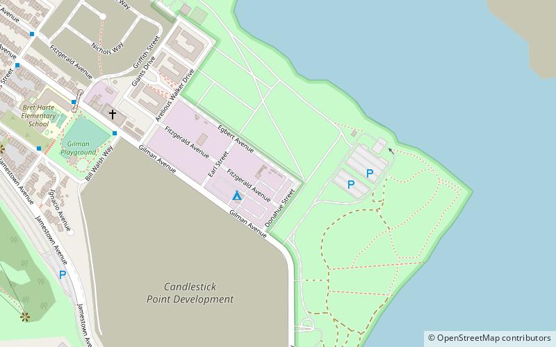
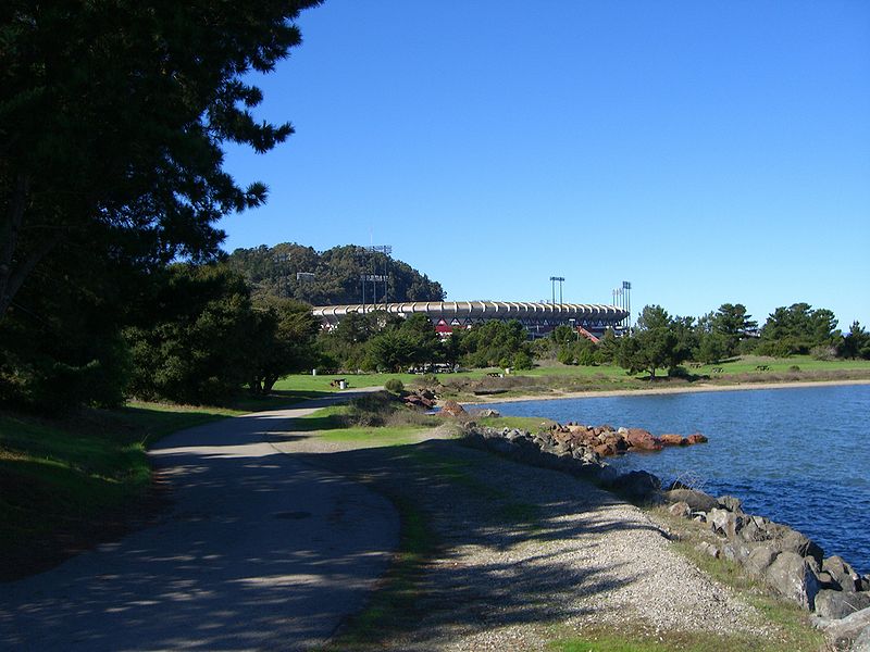
Candlestick Point State Recreation Area is a state park unit of California, United States, providing an urban protected area on San Francisco Bay. The park is located at the southeastern tip of San Francisco immediately south of Hunters Point and 2 miles north of Sierra Point in Brisbane. This 170-acre landfilled area was intended to be used during World War II as a shipyard by the United States Navy. However it was abandoned as the war ended. Without government controls, the area was used by nearby residences as a garbage dump. In 1973 the California State Legislature purchased the land with US$10 million and in 1977 voted to turn this area into a California State Park. After the designation Candlestick became the first urban recreation area in the state. To this day Candlestick remains as a major recreation area in San Francisco, offering a wide view of the bay. The park features various picnic areas, two fishing piers, fitness courses as well as hiking trails. This park is also a popular area for windsurfing due to strong and regular winds. ()
Southeast San Francisco (Candlestick Point State Recreation Area)San Francisco
- Bus
- Light rail
- Train
 Bus
Bus
- Calculate routeGilman Avenue & Bill Walsh Way 8 min walk
- Calculate routeIngerson Avenue & Griffith Street 11 min walk
- Calculate routeHawes Street & Gilman Avenue 13 min walk
- Calculate routeGilman/Paul 22 min walk
- Calculate routeLe Conte 23 min walk
- Calculate routeCarroll 24 min walk
- Calculate routeWilliams 27 min walk
- Calculate routeBayshore 32 min walk
 Muni Metro


Frequently Asked Questions (FAQ)
Which popular attractions are close to Candlestick Point State Recreation Area?
How to get to Candlestick Point State Recreation Area by public transport?
Bus
- Gilman Avenue & Bill Walsh Way • Lines: 29 (8 min walk)
- Ingerson Avenue & Griffith Street • Lines: 29 (11 min walk)
Light rail
- Gilman/Paul • Lines: T (22 min walk)
- Le Conte • Lines: T (23 min walk)
Train
- Bayshore (32 min walk)