Little Hollywood, San Francisco
Map
Facts and practical information
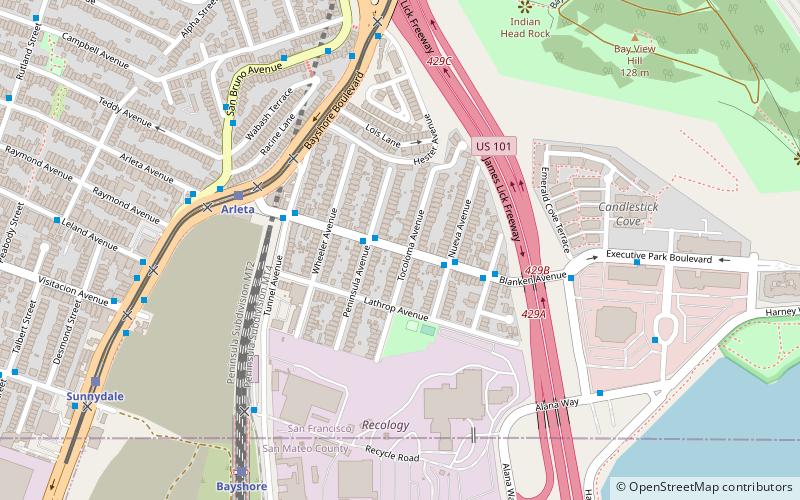
Little Hollywood is a small neighborhood in the southeastern edge of San Francisco. It is centered around Blanken Avenue between Bayshore Boulevard and U.S. Route 101. ()
Area: 62.72 acres (0.098 mi²)Coordinates: 37°42'41"N, 122°23'54"W
Address
Southeast San Francisco (Little Hollywood)San Francisco
ContactAdd
Social media
Add
Getting there by public transportation
Public transportation stops near this location
- Bus
- Light rail
- Train
 Bus
Bus
- Calculate routeBayshore Boulevard & Blanken Avenue 5 min walk
- Calculate routeSan Bruno Avenue & Arleta Avenue 6 min walk
- Calculate routeBayshore Boulevard & Campbell Avenue 6 min walk
- Calculate route3801 San Bruno Avenue 7 min walk
- Calculate routeArleta 6 min walk
- Calculate routeSunnydale 10 min walk
- Calculate routeLe Conte 13 min walk
- Calculate routeGilman/Paul 20 min walk
- Calculate routeBayshore 9 min walk
Maps Muni Metro
Muni MetroDay trips


Frequently Asked Questions (FAQ)
Which popular attractions are close to Little Hollywood?
Nearby attractions include Bayview Park, San Francisco (10 min walk), Visitacion Valley, San Francisco (10 min walk).
How to get to Little Hollywood by public transport?
The nearest stations to Little Hollywood:
Bus
Light rail
Train
Bus
- Bayshore Boulevard & Blanken Avenue • Lines: 292, 397, 91, Bbc, Tbus (5 min walk)
- San Bruno Avenue & Arleta Avenue • Lines: 8, 9, 90, 9R (6 min walk)
Light rail
- Arleta • Lines: T (6 min walk)
- Sunnydale • Lines: T (10 min walk)
Train
- Bayshore (9 min walk)