Silver Terrace, San Francisco
Map
Facts and practical information
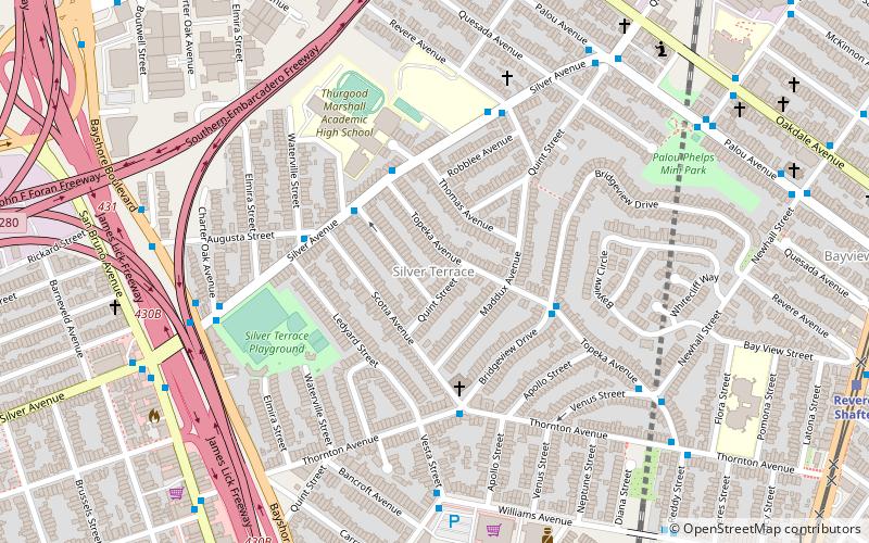
Silver Terrace is a neighborhood in the south eastern corner of San Francisco, between the Bayview and Portola neighborhoods. It is roughly bordered by Third Street to the east, Palou Avenue and Silver Avenue to the north, Williams Avenue to the south and Bayshore Boulevard and U.S. Route 101 to the west. A tunnel used by Caltrain runs under Silver Terrace. ()
Area: 0.38 mi²Coordinates: 37°44'2"N, 122°24'0"W
Address
Southeast San Francisco (Silver Terrace)San Francisco
ContactAdd
Social media
Add
Getting there by public transportation
Public transportation stops near this location
- Bus
- Trolleybus
- Light rail
 Bus
Bus
- Calculate routeSilver Avenue & Santa Fe Avenue 3 min walk
- Calculate routeBridgeview Drive & Topeka Avenue 4 min walk
- Calculate routePalou Avenue & Quint Street 8 min walk
- Calculate routeRevere/Shafter 13 min walk
- Calculate routeOakdale/Palou 13 min walk
- Calculate routeWilliams 14 min walk
- Calculate routeKirkwood/La Salle 16 min walk
Maps Muni Metro
Muni MetroDay trips


Frequently Asked Questions (FAQ)
Which popular attractions are close to Silver Terrace?
Nearby attractions include Bayview Opera House, San Francisco (15 min walk), Bayview–Hunters Point, San Francisco (20 min walk).
How to get to Silver Terrace by public transport?
The nearest stations to Silver Terrace:
Bus
Trolleybus
Light rail
Bus
- Silver Avenue & Santa Fe Avenue • Lines: 44 (3 min walk)
- Bridgeview Drive & Topeka Avenue • Lines: 54 (4 min walk)
Trolleybus
- Palou Avenue & Quint Street • Lines: 24 (8 min walk)
Light rail
- Revere/Shafter • Lines: T (13 min walk)
- Oakdale/Palou • Lines: T (13 min walk)