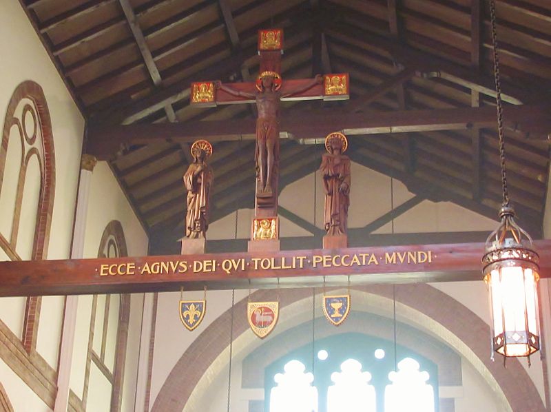
Church of the Saviour, Syracuse

Gallery (2)
Map
Map
Gallery
Facts and practical information
The Church of the Saviour is a chapel in the Episcopal Diocese of Central New York. It is an Anglo-Catholic Episcopal parish noteworthy for its historically significant architecture and decor, which took shape in the late nineteenth and early twentieth centuries. ()
Coordinates: 43°3'12"N, 76°8'51"W
Address
Near NortheastSyracuse
ContactAdd
Social media
Add
Getting there by public transportation
Public transportation stops near this location
- Bus
 Bus
Bus
- Calculate routeB14 18 min walk
- Calculate routeB13 18 min walk
- Calculate routeB12 18 min walk
- Calculate routeC22 18 min walk
Day trips


Frequently Asked Questions (FAQ)
Which popular attractions are close to Church of the Saviour?
Nearby attractions include First English Lutheran Church, Syracuse (3 min walk), Erie Canal Museum, Syracuse (5 min walk), Syracuse City Hall, Syracuse (6 min walk), State Tower Building, Syracuse (7 min walk).
How to get to Church of the Saviour by public transport?
The nearest stations to Church of the Saviour:
Bus
Bus
- B14 • Lines: 110, 116, 120, 121, 16, 20, 21, 216, 22, 316, 410, 410X, 50, 510 (18 min walk)
- B13 • Lines: 176, 186, 76 (18 min walk)