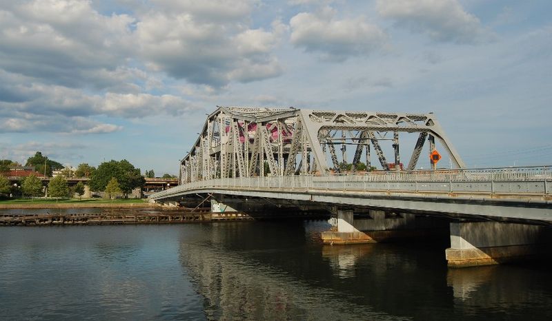
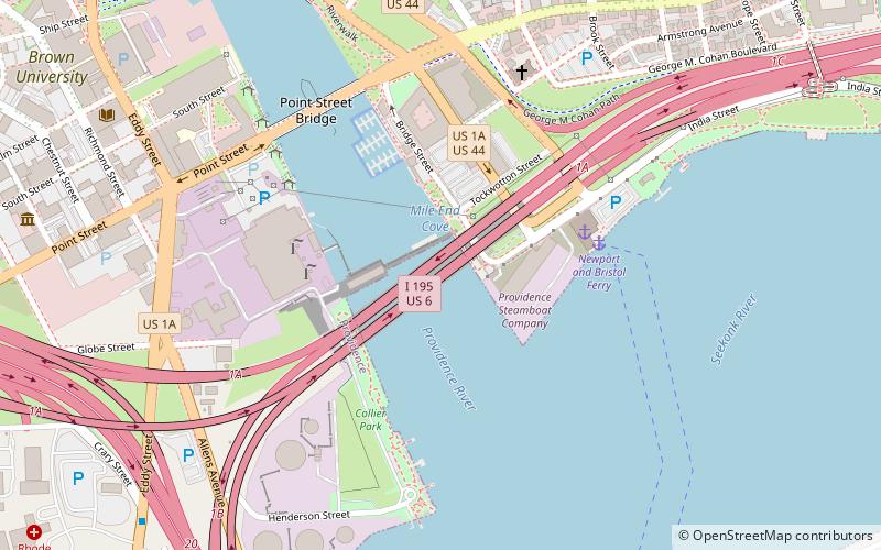
Point Street Bridge, Providence

Gallery (2)
Map
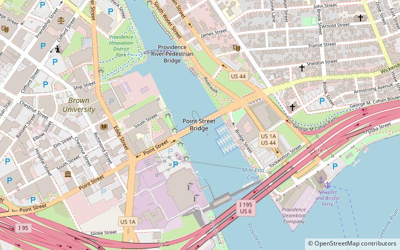
Map
Gallery
Facts and practical information
The Point Street Bridge is a movable bridge that crosses the Providence River in Providence, Rhode Island, carrying Point Street from the Jewelry District to Wickenden Street at the base of College Hill. ()
Opened: 1927 (99 years ago)Length: 528 ftWidth: 39 ftCoordinates: 41°49'5"N, 71°24'13"W
Getting there by public transportation
Public transportation stops near this location
- Bus
- Train
 Bus
Bus
- Calculate routeEddy and Borden 12 min walk
- Calculate routeDorrance and Pine 13 min walk
- Calculate routeKennedy Plaza Intermodal Transportation Center 17 min walk
- Calculate routeKennedy Plaza Stop V 17 min walk
- Calculate routeProvidence 24 min walk
Day trips


Frequently Asked Questions (FAQ)
Which popular attractions are close to Point Street Bridge?
Nearby attractions include Davol Square, Providence (4 min walk), Columbus Square, Providence (4 min walk), Michael S. Van Leesten Memorial Bridge, Providence (5 min walk), Davol Rubber Company, Providence (5 min walk).
How to get to Point Street Bridge by public transport?
The nearest stations to Point Street Bridge:
Bus
Train
Bus
- Eddy and Borden • Lines: 3, 3A, 3B (12 min walk)
- Dorrance and Pine • Lines: 1, 3, 3A, 3B, 62 (13 min walk)
Train
- Providence (24 min walk)