Clatsop Butte, Portland
Map

Gallery

Facts and practical information
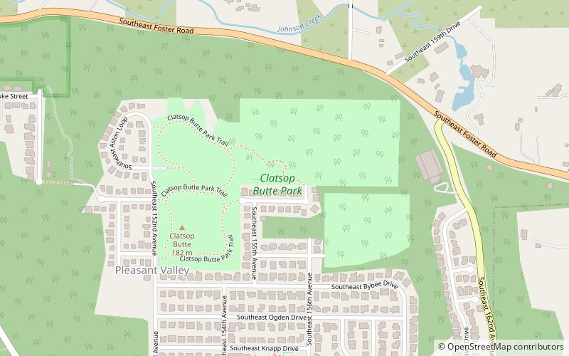
Clatsop Butte is an upland butte lying directly south of Powell Butte in southeast Portland, Oregon, United States. Clatsop Butte City Park, which occupies part of the butte, is at coordinates 45°28′28″N 122°30′24″W at an elevation of 577 feet. Johnson Creek, Southeast Foster Road, and the Springwater Corridor Trail pass between Powell Butte and Clatsop Butte near Southeast 152nd Avenue. ()
Elevation: 577 ftCoordinates: 45°28'26"N, 122°30'11"W
Day trips
Clatsop Butte – popular in the area (distance from the attraction)
Nearby attractions include: Powell Butte, Leach Botanical Garden, Beggars Tick Wildlife Refuge, Ed Benedict Park.
Frequently Asked Questions (FAQ)
How to get to Clatsop Butte by public transport?
The nearest stations to Clatsop Butte:
Bus
Bus
- Southeast 136th & Foster • Lines: 10 (27 min walk)
- 6000 Block Southeast 136th • Lines: 10 (27 min walk)


