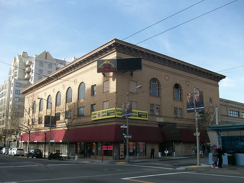
Congregation Sherith Israel, San Francisco

Gallery (1)
Map
Map
Facts and practical information
Congregation Sherith Israel is one of the oldest synagogues in the United States. It was established during California’s Gold Rush period and reflects the ambitions of early Jewish settlers to San Francisco. Today it is a congregation widely known for its innovative approach to worship and lifecycle celebrations and is part of the movement of Reform Judaism. Its historic sanctuary building is one of San Francisco's most prominent architectural landmarks and attracts visitors from all over the world. ()
Getting there by public transportation
Public transportation stops near this location
- Metro
- Bus
- Trolleybus
- Tram
- Light rail
 Metro
Metro
- Calculate routeSacramento Street & Webster Street 2 min walk
- Calculate routeFillmore Street & Sacramento Street 3 min walk
- Calculate routeGeary Boulevard & Webster Street 9 min walk
- Calculate routeGeary Boulevard & Fillmore Street 9 min walk
- Calculate routeCalifornia Street & Van Ness Avenue 15 min walk
- Calculate routeCalifornia Street & Polk Street 16 min walk
- Calculate routeCalifornia Street & Larkin Street 19 min walk
- Calculate routeCalifornia Street & Hyde Street 21 min walk
- Calculate routeVan Ness 31 min walk
- Calculate routeCivic Center 31 min walk
- Calculate routeCivic Center 31 min walk
Maps Muni Metro
Muni MetroDay trips


Frequently Asked Questions (FAQ)
Which popular attractions are close to Congregation Sherith Israel?
Nearby attractions include Fillmore Street, San Francisco (4 min walk), Bush Street Temple, San Francisco (7 min walk), Lafayette Park, San Francisco (7 min walk), Pacific Heights, San Francisco (7 min walk).
How to get to Congregation Sherith Israel by public transport?
The nearest stations to Congregation Sherith Israel:
Trolleybus
Bus
Tram
Light rail
Metro
Trolleybus
- Sacramento Street & Webster Street • Lines: 1 (2 min walk)
- Fillmore Street & Sacramento Street • Lines: 22 (3 min walk)
Bus
- Geary Boulevard & Webster Street • Lines: 38 (9 min walk)
- Geary Boulevard & Fillmore Street • Lines: 38, 38R (9 min walk)
Tram
- California Street & Van Ness Avenue (15 min walk)
- California Street & Polk Street (16 min walk)
Light rail
- Van Ness • Lines: K, N, S, T (31 min walk)
- Civic Center • Lines: K, N, S, T (31 min walk)
Metro
- Civic Center • Lines: Blue, Green, Red, Yellow (31 min walk)