McLaughlin Eastshore State Park, Berkeley
Facts and practical information
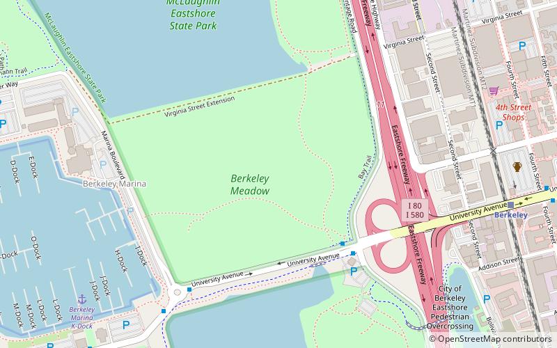
McLaughlin Eastshore State Park is a state park and wildlife refuge along the San Francisco Bay shoreline of the East Bay between the cities of Richmond, Albany, Berkeley, Emeryville, and Oakland. It encompasses remnant natural wetlands, restored wetlands, as well as landfill west of the Eastshore Freeway. Its shoreline is 8.5 miles long, and its total area is 1,854 acres, which includes both tidelands and uplands. Originally named just Eastshore State Park, it was renamed in October 2012 to honor the late Save the Bay founder Sylvia McLaughlin, who, along with the late Dwight Steele of Citizens for Eastshore Park, drove the establishment of the park. Prior to 2013, it was jointly managed by the California State Parks and East Bay Regional Park District. The state agency and EBRPD executed a 30-year agreement for EBRPD to manage the park. ()
University Ave.Berkeley (West Berkeley)Berkeley 94710
- Bus
- Train
 Bus
Bus
- Calculate routeUniversity Avenue & West Frontage Road 5 min walk
- Calculate routeUniversity Avenue & 3rd Street 11 min walk
- Calculate routeBerkeley Marina 11 min walk
- Calculate routeBerkeley 11 min walk


Frequently Asked Questions (FAQ)
Which popular attractions are close to McLaughlin Eastshore State Park?
How to get to McLaughlin Eastshore State Park by public transport?
Bus
- University Avenue & West Frontage Road • Lines: 51B (5 min walk)
- University Avenue & 3rd Street • Lines: 51B, 802 (11 min walk)
Train
- Berkeley (11 min walk)