Mount Pinchot, Kings Canyon National Park
#64 among attractions in Kings Canyon National Park
Facts and practical information
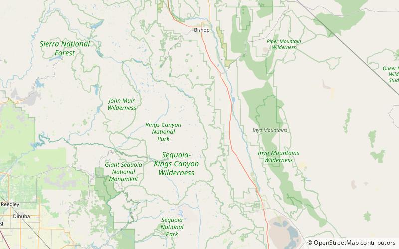
Mount Pinchot is in the Sierra Nevada in the U.S. state of California. Mount Pinchot is in the Sequoia-Kings Canyon Wilderness of Kings Canyon National Park. ()
Kings Canyon National Park United States
Kings Canyon National Park plan & book
Unleash the traveler in you — discover the cheapest flight deals, find the perfect hotel or hostel nearby, and search for the best car rental prices. Travel at your own pace to discover new places and enjoy your journey.
Mount Pinchot – popular in the area (distance from the attraction)
Nearby attractions include: Crater Mountain, Mount Wynne, Vennacher Needle, Mount Ickes.
- 1.9 miSWMountain
Crater Mountain, Kings Canyon National Park
48 min walk • Crater Mountain is a 12,874-foot-elevation mountain summit located west of the crest of the Sierra Nevada mountain range, in Fresno County of northern California, United States.
- 0.7 miSMountain
Mount Wynne, Kings Canyon National Park
17 min walk • Mount Wynne is a 13,179-foot-elevation mountain summit located one mile west of the crest of the Sierra Nevada mountain range, in Fresno County of northern California, United States.
- 5.2 miNWMountain
Vennacher Needle, Kings Canyon National Park
132 min walk • Vennacher Needle is a 12,995-foot-elevation mountain summit located in Kings Canyon National Park, in Fresno County of northern California, United States. It is situated west of the crest of the Sierra Nevada mountain range, and 1.4 miles north of Mount Ruskin.
- 2 miSWMountain
Mount Ickes, Kings Canyon National Park
52 min walk • Mount Ickes is a 12,959-foot-elevation mountain summit located west of the crest of the Sierra Nevada mountain range, in Fresno County of northern California, United States. It is situated in eastern Kings Canyon National Park, 13.5 miles northwest of the community ...
- 4.3 miNWMountain
Mount Ruskin, Kings Canyon National Park
109 min walk • Mount Ruskin is a 12,920-foot-elevation mountain summit located in Kings Canyon National Park, in Fresno County of northern California, United States. It is situated west of the crest of the Sierra Nevada mountain range, immediately east of Cartridge Pass, and 1.4 miles south of Vennacher Needle, the nearest higher neighbor.
- 1.3 miNMountain
Striped Mountain
34 min walk • Striped Mountain is a 13,179-foot-elevation mountain summit located on the crest of the Sierra Nevada mountain range in northern California.
- 3.2 miSMountain
Mount Cedric Wright, Kings Canyon National Park
81 min walk • Mount Cedric Wright is a 12,372-foot-elevation mountain summit located one mile west of the crest of the Sierra Nevada mountain range, in Fresno County of northern California, United States.
- 5.2 miNNature, Natural attraction, Mountain
Split Mountain, John Muir Wilderness
132 min walk • Split Mountain is a fourteener in the Sierra Nevada of the U.S. state of California, near the southeast end of the Palisades group of peaks.
- 4.8 miWNature, Natural attraction, Mountain
Arrow Peak, Kings Canyon National Park
123 min walk • Arrow Peak is a 12,962-foot summit of the Sierra Nevada in Fresno County, California, located within Kings Canyon National Park. Arrow Peak is situated at the north end of the Muro Blanco, a chain of high cliffs along the South Fork Kings River.
- 5 miSENature, Natural attraction, Mountain pass
Sawmill Pass, Kings Canyon National Park
128 min walk • Sawmill Pass, 11,309 ft, is a mountain pass in the southern Sierra Nevada, California on the border of the Inyo National Forest to the east and Kings Canyon National Park to the west.
- 2.6 miNNature, Natural attraction, Mountain pass
Taboose Pass, John Muir Wilderness
68 min walk • Taboose Pass, 11,417 ft, also known as Wide Gap, is a mountain pass in the southern Sierra Nevada, California on the border of the Inyo National Forest to the east and Kings Canyon National Park to the west.