Royal Arches Route, Yosemite National Park
Facts and practical information
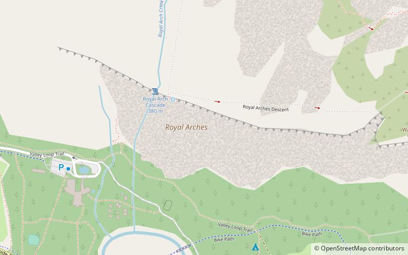
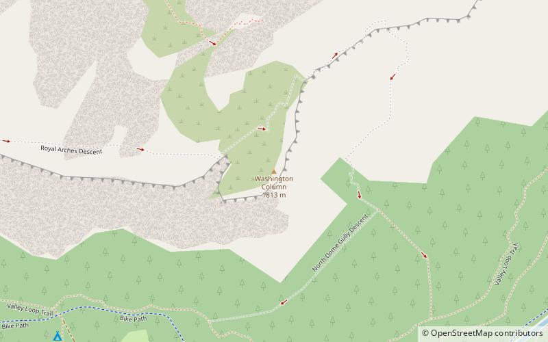
The Royal Arches Route is a technical climbing route in California's Yosemite Valley on the Royal Arches wall. The route is recognized in the historic climbing text Fifty Classic Climbs of North America. The route was first climbed Oct. 1936 by Ken Adam, Morgan Harris, K. Kenneth Davis. The route is moderate in difficulty and is frequently climbed. The first 4 pitches are along a west facing dihedral. At Pitch 5, the route turns north and ascends the main face along crack systems. Pitch 10 can be free climbed at 5.10b however, most climbers use a fixed rope to pendulum to a long ledge. At the end of Pitch 15, begins the bolted rappel route. It is 18 rappels to the Valley floor. Some climbers prefer to continue to "The Jungle" at the end of Pitch 16. Beyond The Jungle is a 5.4 slab and 4th Class scrambling to the Valley Rim. The descent is usually accomplished by traversing northeast to Washington Column and descending the exposed North Dome Gully. ()
Yosemite National Park
- Bus
 Bus
Bus
- Calculate routeValley Shuttle Stop #3 9 min walk


Frequently Asked Questions (FAQ)
Which popular attractions are close to Royal Arches Route?
How to get to Royal Arches Route by public transport?
Bus
- Valley Shuttle Stop #3 • Lines: Yosemite Valley Shuttle (9 min walk)