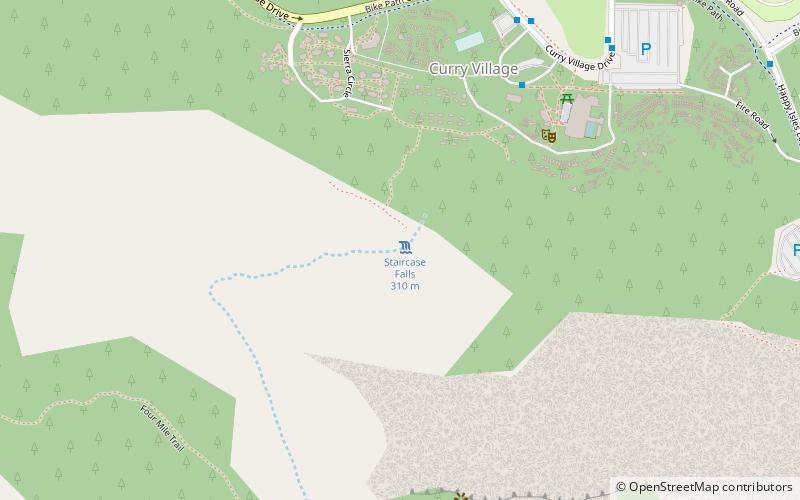
Staircase Falls, Yosemite West

Gallery (1)
Map
Map
Facts and practical information
Staircase Falls is a series of waterfalls located on Gossamer Creek in Yosemite National Park, California. The falls descend a total of 1,300 feet into Yosemite Valley over a series of steps. Staircase Falls is relatively ephemeral and is usually dry by the end of the month of June. The falls are located immediately behind Camp Curry on cliffs below Glacier Point. ()
Address
Yosemite West
ContactAdd
Social media
Add
Getting there by public transportation
Public transportation stops near this location
- Bus
 Bus
Bus
- Calculate routeValley Shuttle Stop #13b 7 min walk
Day trips


Frequently Asked Questions (FAQ)
Which popular attractions are close to Staircase Falls?
Nearby attractions include Curry Village, Yosemite National Park (6 min walk), Glacier Point, Yosemite National Park (8 min walk), Glacier Point Trailside Museum, Yosemite National Park (9 min walk), LeConte Memorial Lodge, Yosemite National Park (10 min walk).
How to get to Staircase Falls by public transport?
The nearest stations to Staircase Falls:
Bus
Bus
- Valley Shuttle Stop #13b • Lines: Yosemite Valley Shuttle (7 min walk)