Southern Exposure, San Francisco

Gallery (1)
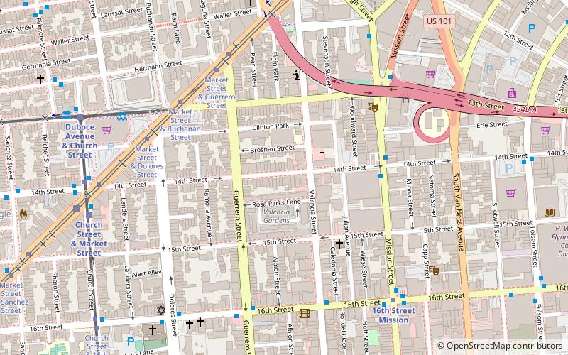
Map
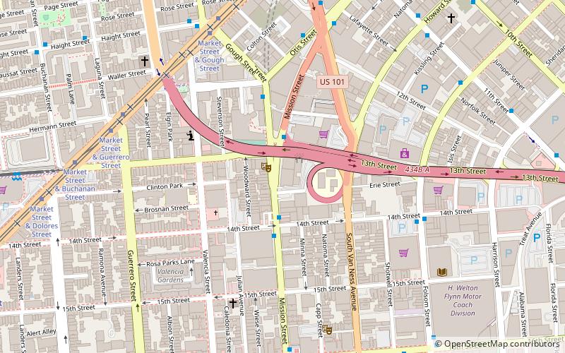
Map
Facts and practical information
Southern Exposure is a not-for-profit arts organization and alternative art space founded in 1974 in the Mission District of San Francisco, California. It was originally founded as a grassroots, cooperative art gallery in conjunction with Project Artaud which was a live/work artist community. By the 1980s, they converted the gallery to a community space for supporting emerging artists. ()
Established: 1974 (52 years ago)Coordinates: 37°46'5"N, 122°25'23"W
Getting there by public transportation
Public transportation stops near this location
- Metro
- Bus
- Trolleybus
- Tram
- Light rail
 Metro
Metro
- Calculate routeMission Street & 14th Street 5 min walk
- Calculate route150 Otis Street 7 min walk
- Calculate route16th Street & Mission Street 7 min walk
- Calculate routeMission Street & 16th Street 7 min walk
- Calculate routeMission Street & 14th Street 5 min walk
- Calculate route16th Street & Valencia Street 6 min walk
- Calculate routeMarket Street & Guerrero Street 6 min walk
- Calculate route16th Street Mission 7 min walk
- Calculate routeCivic Center 25 min walk
- Calculate routeChurch Street & 14th Street 9 min walk
- Calculate routeDuboce Avenue & Church Street 10 min walk
Maps Muni Metro
Muni MetroDay trips
Southern Exposure – popular in the area (distance from the attraction)
Nearby attractions include: Mission Workshop, Wiggle Bicycles, Market Street, Mission Dolores.


Frequently Asked Questions (FAQ)
Which popular attractions are close to Southern Exposure?
Nearby attractions include Episcopal Church of St. John the Evangelist, San Francisco (4 min walk), Intersection for the Arts, San Francisco (5 min walk), Woodward's Gardens, San Francisco (6 min walk), California Volunteers Sculpture, San Francisco (6 min walk).
How to get to Southern Exposure by public transport?
The nearest stations to Southern Exposure:
Bus
Trolleybus
Tram
Metro
Light rail
Bus
- Mission Street & 14th Street • Lines: 49 (5 min walk)
- 150 Otis Street • Lines: 49 (7 min walk)
Trolleybus
- Mission Street & 14th Street • Lines: 14 (5 min walk)
- 16th Street & Valencia Street • Lines: 22 (6 min walk)
Tram
- Market Street & Guerrero Street • Lines: F (6 min walk)
Metro
- 16th Street Mission • Lines: Blue, Green, Red, Yellow (7 min walk)
- Civic Center • Lines: Blue, Green, Red, Yellow (25 min walk)
Light rail
- Church Street & 14th Street • Lines: J (9 min walk)
- Duboce Avenue & Church Street • Lines: N (10 min walk)