UMSL, St. Louis
Map
Facts and practical information
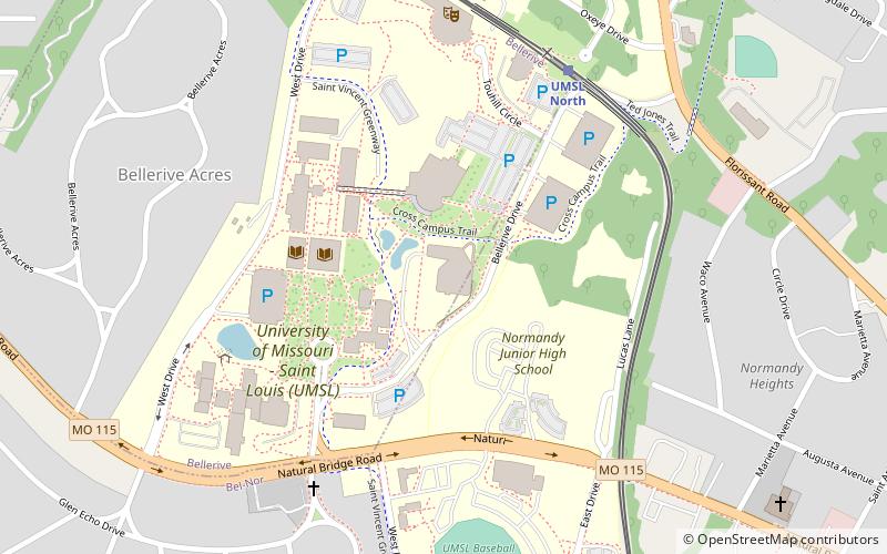
The University of Missouri–St. Louis is a public research university in St. Louis, Missouri. Established in 1963, it is one of four universities in the University of Missouri System and its newest. UMSL's campus is located on the former grounds of the Bellerive Country Club in St. Louis County, with an address in St. Louis city. The campus stretches into the municipalities of Bellerive, Bel-Nor and Normandy. Additional facilities are located at the former site of Marillac College and at Grand Center, both in St. Louis city. ()
Getting there by public transportation
Public transportation stops near this location
- Bus
- Light rail
 Bus
Bus
- Calculate routeUMSL North 7 min walk
- Calculate routeUMSL South 10 min walk
- Calculate routeNorth Hanley 20 min walk
- Calculate routeMetroLink North Hanley Station 20 min walk
Day trips


Frequently Asked Questions (FAQ)
How to get to UMSL by public transport?
The nearest stations to UMSL:
Light rail
Bus
Light rail
- UMSL North • Lines: Red (7 min walk)
- UMSL South • Lines: Red (10 min walk)
Bus
- MetroLink North Hanley Station • Lines: Scat (20 min walk)