Second Church of Christ, San Francisco

Gallery (1)
Map
Map
Facts and practical information
The former Second Church of Christ, Scientist is an historic Christian Science church building located at the corner of Dolores Street and Cumberland Street, across from Dolores Park in the Mission District of San Francisco, California. Built in 1916, it was designed by San Francisco architect William H. Crim in the Beaux Arts style. The building was sold in 2012, and conversion into four condominiums was completed in 2016. ()
Coordinates: 37°47'26"N, 122°25'26"W
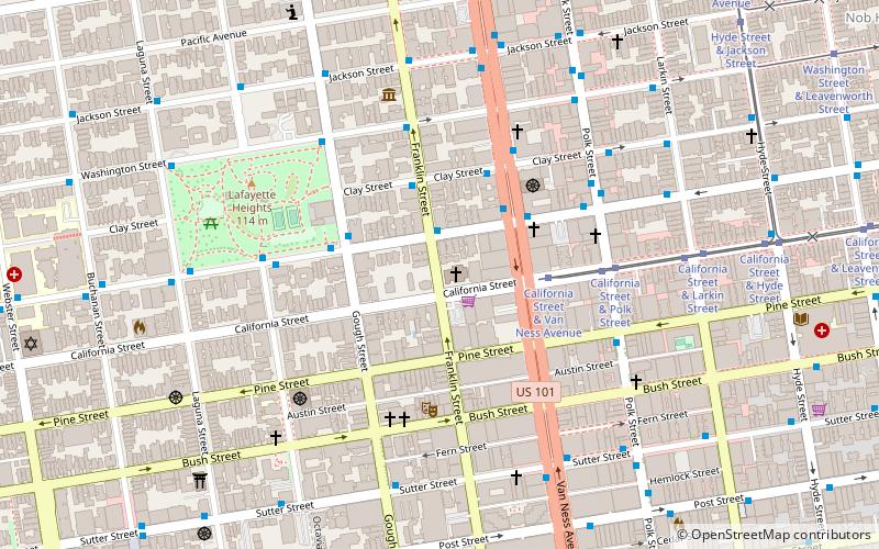
Address
1700 Franklin StNorthwest San Francisco (Pacific Heights)San Francisco 94109-3527
Contact
+1 415-673-3544
Social media
Add
Getting there by public transportation
Public transportation stops near this location
- Metro
- Bus
- Trolleybus
- Tram
- Light rail
 Metro
Metro
- Calculate routeSacramento Street & Franklin Street 2 min walk
- Calculate routeClay Street & Franklin Street 3 min walk
- Calculate routeGough Street & Sacramento Street 3 min walk
- Calculate routeVan Ness Avenue & Sacramento Street 3 min walk
- Calculate routePolk Street & Sacramento Street 5 min walk
- Calculate routeCalifornia Street & Van Ness Avenue 3 min walk
- Calculate routeCalifornia Street & Polk Street 5 min walk
- Calculate routeCalifornia Street & Larkin Street 7 min walk
- Calculate routeCalifornia Street & Hyde Street 10 min walk
- Calculate routeCivic Center 24 min walk
- Calculate routePowell Street 26 min walk
- Calculate routeCivic Center 24 min walk
- Calculate routePowell Street 26 min walk
- Calculate routeVan Ness 28 min walk
Maps Muni Metro
Muni MetroDay trips


Frequently Asked Questions (FAQ)
Which popular attractions are close to Second Church of Christ?
Nearby attractions include C. A. Belden House, San Francisco (2 min walk), Academy of Art University Automobile Museum, San Francisco (5 min walk), Haas-Lilienthal House, San Francisco (6 min walk), Polk Street, San Francisco (6 min walk).
How to get to Second Church of Christ by public transport?
The nearest stations to Second Church of Christ:
Trolleybus
Bus
Tram
Metro
Light rail
Trolleybus
- Sacramento Street & Franklin Street • Lines: 1 (2 min walk)
- Clay Street & Franklin Street • Lines: 1 (3 min walk)
Bus
- Van Ness Avenue & Sacramento Street • Lines: 101, 101X, 24C, 30, 49, 4C, 54C, 70, 90 (3 min walk)
- Polk Street & Sacramento Street • Lines: 19 (5 min walk)
Tram
- California Street & Van Ness Avenue (3 min walk)
- California Street & Polk Street (5 min walk)
Metro
- Civic Center • Lines: Blue, Green, Red, Yellow (24 min walk)
- Powell Street • Lines: Blue, Green, Red, Yellow (26 min walk)
Light rail
- Civic Center • Lines: K, N, S, T (24 min walk)
- Powell Street • Lines: K, N, S, T (26 min walk)