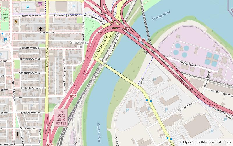
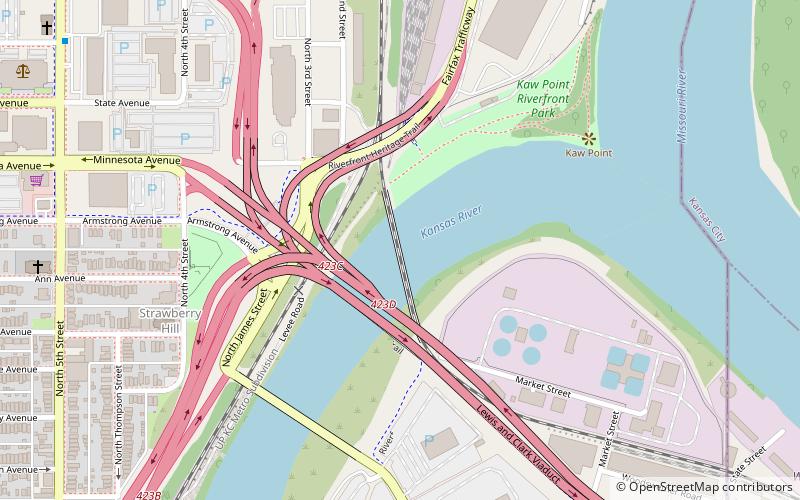
James Street Bridge, Kansas City
Map
Facts and practical information
The James Street Bridge is a car crossing of the Kansas River at Kansas City. It is the second bridge at this location. ()
Opened: 1904 (122 years ago)Coordinates: 39°6'41"N, 94°36'59"W
Address
Downtown Kansas City (Central Industrial District)Kansas City
ContactAdd
Social media
Add
Getting there by public transportation
Public transportation stops near this location
- Bus
 Bus
Bus
- Calculate routeWyoming at 12th 27 min walk
- Calculate route12th at Liberty 27 min walk
- Calculate route14th at Wyoming 29 min walk
Day trips


Frequently Asked Questions (FAQ)
Which popular attractions are close to James Street Bridge?
Nearby attractions include Strawberry Hill Museum and Cultural Center, Kansas City (6 min walk), Union Pacific Bridge, Kansas City (6 min walk), Port of Kansas City, Kansas City (9 min walk), Kansas City Southern Bridge, Kansas City (9 min walk).
How to get to James Street Bridge by public transport?
The nearest stations to James Street Bridge:
Bus
Bus
- Wyoming at 12th • Lines: 9 (27 min walk)
- 12th at Liberty • Lines: 9 (27 min walk)