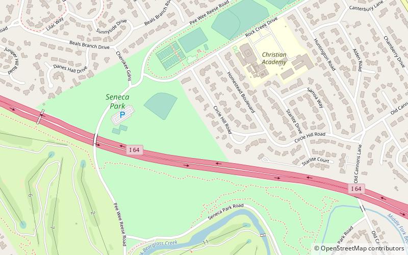
Seneca Park, Louisville
Map
Facts and practical information
Seneca Park was the last park designed by Frederick Law Olmsted's firm in Louisville, Kentucky, United States. The park system in Louisville was the last of five designed by the Olmsted firm. The park resides in the Louisville neighborhood of Seneca Gardens, Kentucky.The park has been updated over the years to include restrooms and playground equipment that supplements a myriad of trails for people or horses. ()
Created: 1928Elevation: 522 ft a.s.l.Coordinates: 38°14'24"N, 85°40'16"W
Address
East Louisville (Rockcreek Lexington Road)Louisville
ContactAdd
Social media
Add
Getting there by public transportation
Public transportation stops near this location
- Bus
 Bus
Bus
- Calculate routeAlta Vista / Red Fox 15 min walk
- Calculate routeLexington / Dover 16 min walk
Day trips


Frequently Asked Questions (FAQ)
Which popular attractions are close to Seneca Park?
Nearby attractions include Shawnee Park, Louisville (8 min walk), Rockcreek-Lexington Road, Louisville (9 min walk), Cherokee Gardens, Louisville (14 min walk), Whitehall House & Gardens, Louisville (15 min walk).
How to get to Seneca Park by public transport?
The nearest stations to Seneca Park:
Bus
Bus
- Alta Vista / Red Fox • Lines: 29East Oxmoor (15 min walk)
- Lexington / Dover • Lines: 29East Oxmoor, 29West Oxmoor (16 min walk)