Miramar Beach, Half Moon Bay
Map
Facts and practical information
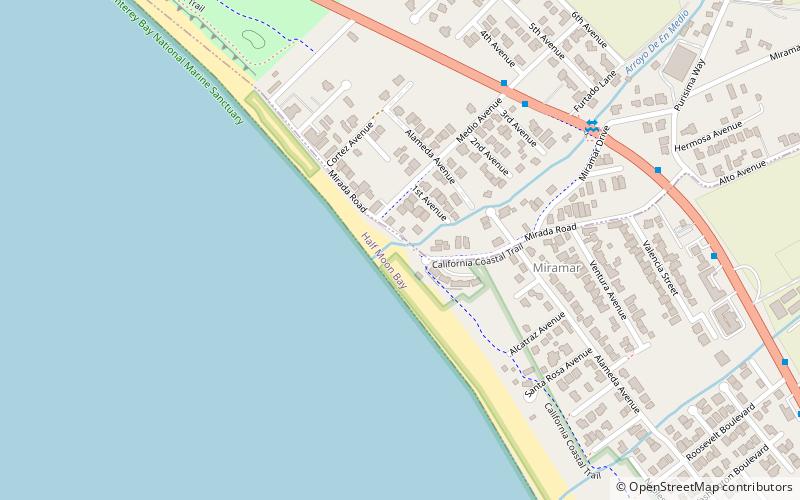
Miramar Beach is a sandy beach in western San Mateo County, California. Miramar Beach is one of the numerous beaches on Half Moon Bay, a Pacific Ocean embayment noted for its surfing and extensive visitation. The marine terrace above the beach itself is situated approximately eight meters above mean sea level, and on this terrace is positioned the small unincorporated community of Miramar, which is a residential setting that also has several coastal visitor serving uses such as restaurant and lodging facilities. A stream named Arroyo de en Medio discharges onto Miramar Beach into the Pacific Ocean. ()
Coordinates: 37°29'36"N, 122°27'36"W
Getting there by public transportation
Public transportation stops near this location
- Bus
 Bus
Bus
- Calculate routeNorth Cabrillo Highway & Medio Avenue 6 min walk
- Calculate route3040 North Cabrillo Highway 10 min walk
- Calculate routeMain Street & Roosevelt Boulevard 13 min walk
Day trips


Frequently Asked Questions (FAQ)
How to get to Miramar Beach by public transport?
The nearest stations to Miramar Beach:
Bus
Bus
- North Cabrillo Highway & Medio Avenue • Lines: 17 (6 min walk)
- 3040 North Cabrillo Highway • Lines: 17 (10 min walk)