Kezar Pavilion, San Francisco
Map

Map

Facts and practical information
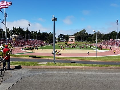
Kezar Pavilion, located adjacent to Kezar Stadium, is an indoor arena in the southeast corner of Golden Gate Park, San Francisco, California, United States. Built in 1924, the Pavilion seats 4,000 people and is owned and operated by the City of San Francisco. The San Francisco Rumble, of the American Basketball Association, and the Academy of Art Urban Knights, an NCAA Division II school, call Kezar Pavilion their home court. ()
Opened: 1924 (102 years ago)Capacity: 4000Coordinates: 37°46'3"N, 122°27'14"W
Address
755 Stanyan StNorthwest San Francisco (Golden Gate Park)San Francisco 94117
Contact
(415) 753-7032
Social media
Add
Day trips
Kezar Pavilion – popular in the area (distance from the attraction)
Nearby attractions include: de Young Museum, California Academy of Sciences, Haight Street, Japanese Tea Garden.
Frequently Asked Questions (FAQ)
Which popular attractions are close to Kezar Pavilion?
Nearby attractions include Cole Valley, San Francisco (7 min walk), AIDS Memorial Grove, San Francisco (11 min walk), Haight-Ashbury, San Francisco (11 min walk), Panhandle, San Francisco (12 min walk).
How to get to Kezar Pavilion by public transport?
The nearest stations to Kezar Pavilion:
Bus
Trolleybus
Light rail
Train
Tram
Bus
- Stanyan Street & Waller Street • Lines: 7 (2 min walk)
- Frederick Street & Willard Street • Lines: 7 (3 min walk)
Trolleybus
- Haight Street & Stanyan Street • Lines: 33 (4 min walk)
- Stanyan Street & Hayes Street • Lines: 33 (10 min walk)
Light rail
- Carl Street & Stanyan Street • Lines: N (4 min walk)
- Irving Street & Arguello Boulevard • Lines: N (8 min walk)
Train
- Carl Street & Cole Street (7 min walk)
- UCSF Parnassus (9 min walk)
Tram
- 17th Street & Castro Street • Lines: F (29 min walk)
- Market Street & Noe Street • Lines: F (30 min walk)

 Muni Metro


