Bill Graham Civic Auditorium, San Francisco
Facts and practical information
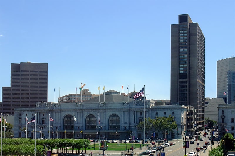
The Bill Graham Civic Auditorium is a historic landmark nestled in the heart of San Francisco, United States. This versatile venue, renowned for hosting a variety of events, has been a cornerstone of the city's cultural and entertainment scene for decades. Originally built as part of the Exposition Auditorium for the 1915 Panama-Pacific International Exposition, it was later named after the legendary concert promoter Bill Graham.
The auditorium is not just a sport venue but a multipurpose facility that has seen an array of events, from political conventions to rock concerts, and basketball games to graduation ceremonies. Its expansive interior, which can accommodate up to 8,500 people, is designed to be flexible, allowing for a wide range of configurations to suit different types of events.
Throughout its history, the Bill Graham Civic Auditorium has been a stage for some of the most memorable moments in entertainment and sports. Its central location, within walking distance of City Hall and other civic landmarks, makes it an easily accessible destination for both locals and visitors.
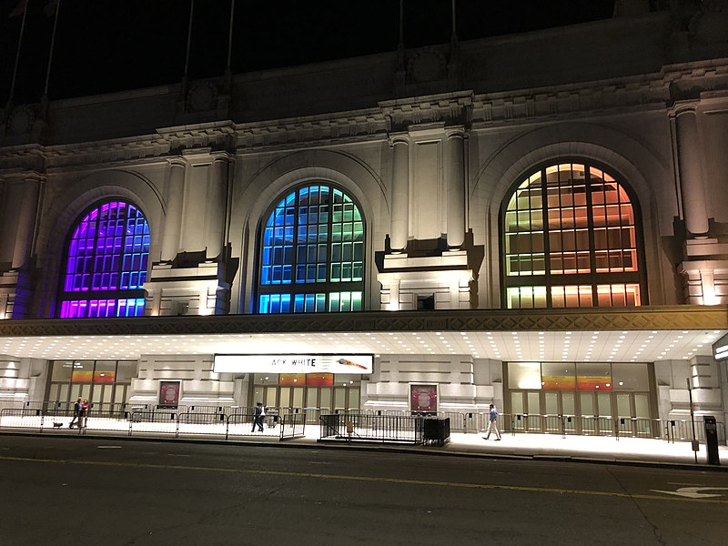
The venue's facade, with its Beaux-Arts architecture, exudes an air of grandeur and timelessness, while the interior has been updated with modern amenities to enhance the experience of attendees. Whether it's for a high-energy concert, a major sporting event, or a community gathering, the Bill Graham Civic Auditorium continues to be a vibrant part of San Francisco's heritage.
- Metro
- Bus
- Trolleybus
- Tram
- Light rail
 Metro
Metro
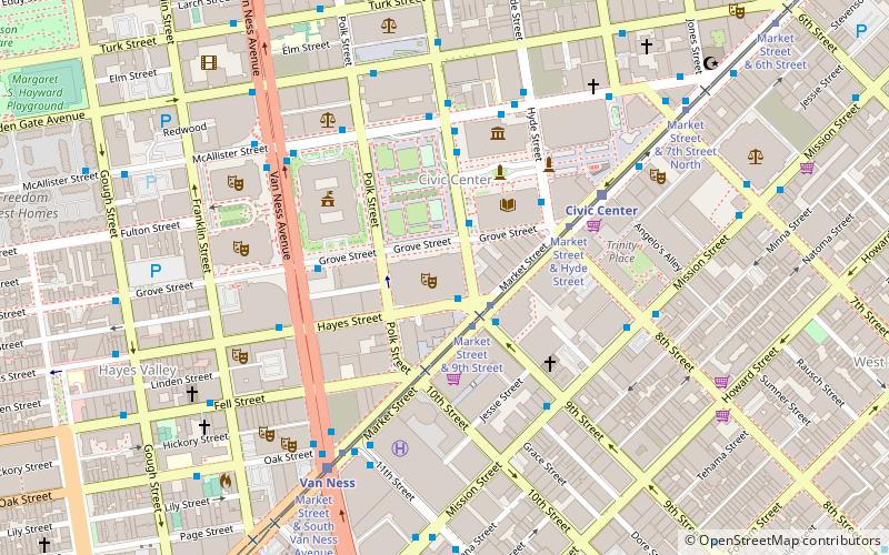
- Calculate routeMarket Street & Larkin Street 2 min walk
- Calculate routeLarkin Street & Grove Street 2 min walk
- Calculate route9th Street & Market Street 2 min walk
- Calculate routeHyde Street & Grove Street 4 min walk
- Calculate routeMarket Street & Hyde Street 4 min walk
- Calculate routeMission Street & 9th Street 5 min walk
- Calculate routeCivic Center 6 min walk
- Calculate routeVan Ness 7 min walk
- Calculate routePowell Street 18 min walk
- Calculate routeDuboce Avenue & Church Street 23 min walk
- Calculate routeCivic Center 6 min walk
- Calculate routePowell Street 18 min walk
 Muni Metro


Frequently Asked Questions (FAQ)
Which popular attractions are close to Bill Graham Civic Auditorium?
How to get to Bill Graham Civic Auditorium by public transport?
Tram
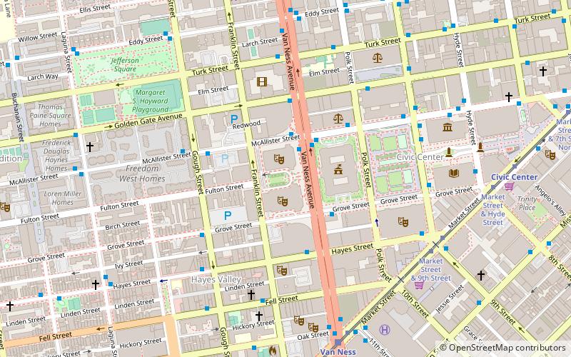
- Market Street & Larkin Street • Lines: F (2 min walk)
Bus
- Larkin Street & Grove Street • Lines: 19 (2 min walk)
- 9th Street & Market Street • Lines: Cca (2 min walk)
Trolleybus
- Mission Street & 9th Street • Lines: 14 (5 min walk)
Light rail
- Civic Center • Lines: K, N, S, T (6 min walk)
- Van Ness • Lines: K, N, S, T (7 min walk)
Metro
- Civic Center • Lines: Blue, Green, Red, Yellow (6 min walk)
- Powell Street • Lines: Blue, Green, Red, Yellow (18 min walk)