Louise M. Davies Symphony Hall, San Francisco

Gallery (3)
Map
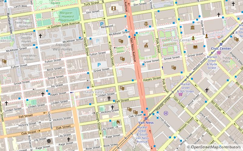
Map
Gallery
Facts and practical information
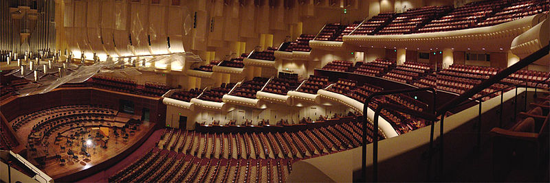
Louise M. Davies Symphony Hall is the concert hall component of the San Francisco War Memorial and Performing Arts Center in San Francisco, California. The 2,743-seat hall was completed in 1980 at a cost of US$28 million to give the San Francisco Symphony a permanent home. ()
Getting there by public transportation
Public transportation stops near this location
- Metro
- Bus
- Trolleybus
- Tram
- Light rail
 Metro
Metro
- Calculate routeVan Ness Avenue & McAllister Street 5 min walk
- Calculate routeMcAllister Street & Van Ness Avenue 5 min walk
- Calculate routeMarket Street & Van Ness Avenue 5 min walk
- Calculate routeVan Ness 5 min walk
- Calculate routeCivic Center 11 min walk
- Calculate routeDuboce Avenue & Church Street 19 min walk
- Calculate routeChurch Street & Duboce Avenue 19 min walk
- Calculate routeMission Street & 11th Street 8 min walk
- Calculate routeOtis Street & 12th Street 9 min walk
- Calculate routeCivic Center 11 min walk
- Calculate route16th Street Mission 22 min walk
Maps Muni Metro
Muni MetroDay trips
Louise M. Davies Symphony Hall – popular in the area (distance from the attraction)
Nearby attractions include: Bill Graham Civic Auditorium, San Francisco City Hall, Cathedral of Saint Mary of the Assumption, Market Street.


Frequently Asked Questions (FAQ)
Which popular attractions are close to Louise M. Davies Symphony Hall?
Nearby attractions include Nourse Theater, San Francisco (1 min walk), War Memorial Opera House, San Francisco (2 min walk), San Francisco Ballet, San Francisco (2 min walk), San Francisco Veterans Memorial, San Francisco (3 min walk).
How to get to Louise M. Davies Symphony Hall by public transport?
The nearest stations to Louise M. Davies Symphony Hall:
Bus
Tram
Light rail
Trolleybus
Metro
Bus
- Van Ness Avenue & McAllister Street • Lines: 49, 90 (5 min walk)
- McAllister Street & Van Ness Avenue • Lines: 5 (5 min walk)
Tram
- Market Street & Van Ness Avenue • Lines: F (5 min walk)
Light rail
- Van Ness • Lines: K, N, S, T (5 min walk)
- Civic Center • Lines: K, N, S, T (11 min walk)
Trolleybus
- Mission Street & 11th Street • Lines: 14 (8 min walk)
- Otis Street & 12th Street • Lines: 14 (9 min walk)
Metro
- Civic Center • Lines: Blue, Green, Red, Yellow (11 min walk)
- 16th Street Mission • Lines: Blue, Green, Red, Yellow (22 min walk)