San Francisco Veterans Memorial, San Francisco
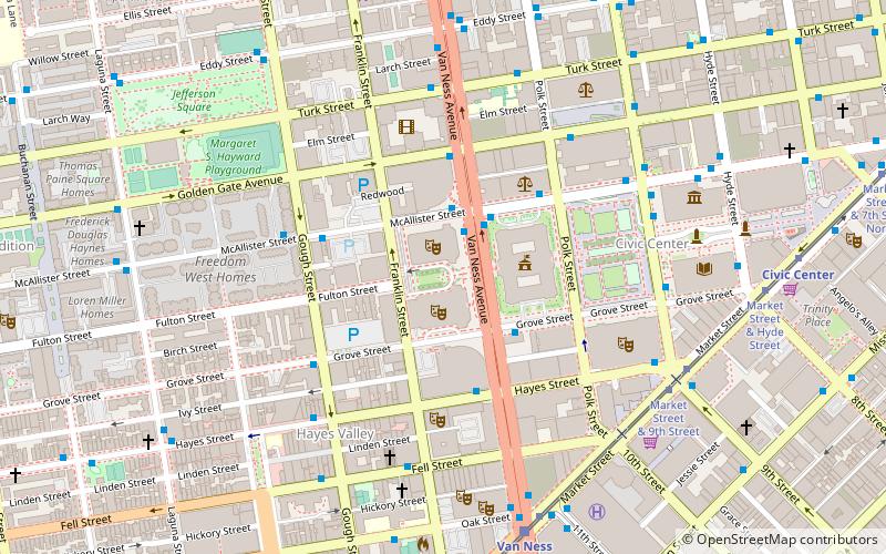
Map
Facts and practical information
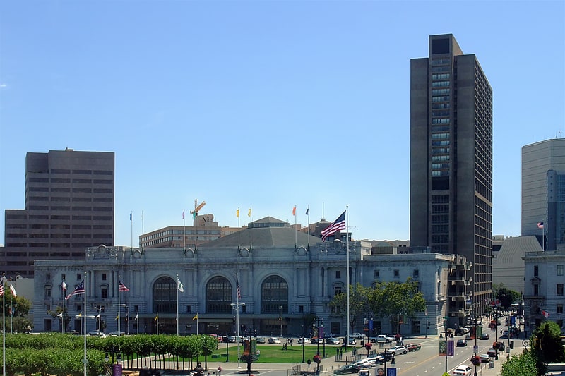
The San Francisco Veterans Memorial is a memorial commemorating veterans in San Francisco's Civic Center, in the U.S. state of California. The stone octagon memorial, located across from San Francisco City Hall between Herbst Theatre and War Memorial Opera House, was dedicated in 2014. Inscribed in the stone is Archibald MacLeish's poem, "The Young Dead Soldiers Do Not Speak". ()
Coordinates: 37°46'45"N, 122°25'15"W
Address
Northeast San Francisco (Civic Center)San Francisco
ContactAdd
Social media
Add
Getting there by public transportation
Public transportation stops near this location
- Metro
- Bus
- Trolleybus
- Tram
- Light rail
 Metro
Metro
- Calculate routeVan Ness Avenue & McAllister Street 2 min walk
- Calculate routeMcAllister Street & Van Ness Avenue 2 min walk
- Calculate routeMcAllister Street & Polk Street 4 min walk
- Calculate routeMarket Street & 9th Street 7 min walk
- Calculate routeVan Ness 8 min walk
- Calculate routeCivic Center 10 min walk
- Calculate routeDuboce Avenue & Church Street 21 min walk
- Calculate routeChurch Street & Duboce Avenue 21 min walk
- Calculate routeMission Street & 9th Street 10 min walk
- Calculate routeCivic Center 10 min walk
- Calculate routePowell Street 22 min walk
Maps Muni Metro
Muni MetroDay trips
San Francisco Veterans Memorial – popular in the area (distance from the attraction)
Nearby attractions include: Great American Music Hall, Bill Graham Civic Auditorium, San Francisco City Hall, Cathedral of Saint Mary of the Assumption.


Frequently Asked Questions (FAQ)
Which popular attractions are close to San Francisco Veterans Memorial?
Nearby attractions include Herbst Theatre, San Francisco (1 min walk), War Memorial Opera House, San Francisco (1 min walk), Museum of Performance & Design, San Francisco (1 min walk), San Francisco War Memorial and Performing Arts Center, San Francisco (2 min walk).
How to get to San Francisco Veterans Memorial by public transport?
The nearest stations to San Francisco Veterans Memorial:
Bus
Tram
Light rail
Trolleybus
Metro
Bus
- Van Ness Avenue & McAllister Street • Lines: 49, 90 (2 min walk)
- McAllister Street & Van Ness Avenue • Lines: 5 (2 min walk)
Tram
- Market Street & 9th Street • Lines: F (7 min walk)
Light rail
- Van Ness • Lines: K, N, S, T (8 min walk)
- Civic Center • Lines: K, N, S, T (10 min walk)
Trolleybus
- Mission Street & 9th Street • Lines: 14 (10 min walk)
Metro
- Civic Center • Lines: Blue, Green, Red, Yellow (10 min walk)
- Powell Street • Lines: Blue, Green, Red, Yellow (22 min walk)