Hawley Street, Boston
Map
Facts and practical information
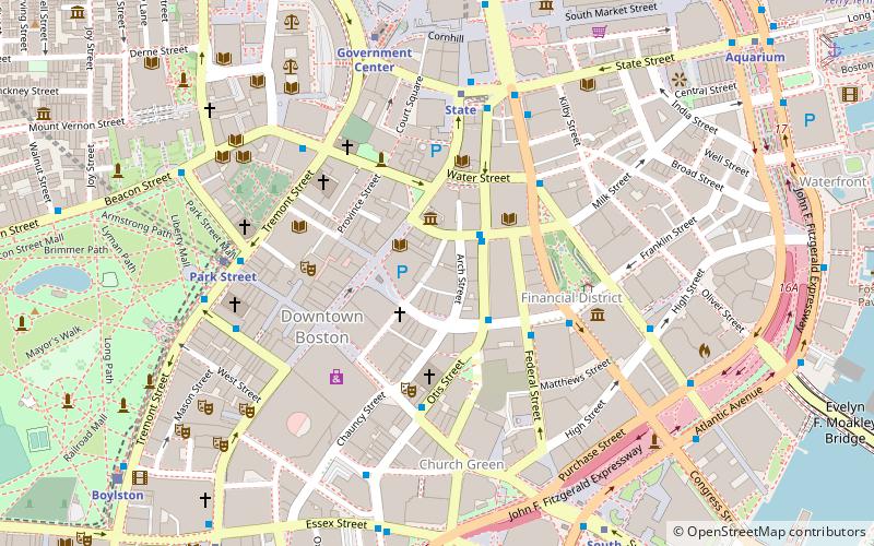
Hawley Street of Boston, Massachusetts, is located in the Financial District between Milk and Summer Streets. Prior to 1799, it was called Bishop's Alley and briefly in the 1790s Board Alley. ()
Coordinates: 42°21'22"N, 71°3'30"W
Address
Downtown BostonBoston
ContactAdd
Social media
Add
Getting there by public transportation
Public transportation stops near this location
- Metro
- Bus
- Light rail
- Train
 Metro
Metro
- Calculate routeFederal St @ Franklin St 3 min walk
- Calculate routeOtis St @ Summer St 4 min walk
- Calculate routeTremont St opp Temple Pl 7 min walk
- Calculate routeLincoln St @ Essex St 8 min walk
- Calculate routeDowntown Crossing 3 min walk
- Calculate routeState 4 min walk
- Calculate routePark Street 7 min walk
- Calculate routeGovernment Center 7 min walk
- Calculate routePark Street 6 min walk
- Calculate routeGovernment Center 7 min walk
- Calculate routeBoylston 10 min walk
- Calculate routeHaymarket 11 min walk
- Calculate routeBoston South Station 10 min walk
- Calculate routeBoston North Station 19 min walk
- Calculate routeBoston Back Bay 27 min walk
Maps MBTA Subway
MBTA SubwayDay trips


Frequently Asked Questions (FAQ)
Which popular attractions are close to Hawley Street?
Nearby attractions include Old South Meeting House, Boston (2 min walk), Washington Street, Boston (2 min walk), Newspaper Row, Boston (2 min walk), Irish Famine Memorial, Boston (3 min walk).
How to get to Hawley Street by public transport?
The nearest stations to Hawley Street:
Bus
Metro
Light rail
Train
Bus
- Federal St @ Franklin St • Lines: 504 (3 min walk)
- Otis St @ Summer St • Lines: 504, 7 (4 min walk)
Metro
- Downtown Crossing • Lines: Orange, Red (3 min walk)
- State • Lines: Blue, Orange (4 min walk)
Light rail
- Park Street • Lines: B, C, D, E (6 min walk)
- Government Center • Lines: C, D, E (7 min walk)
Train
- Boston South Station (10 min walk)
- Boston North Station (19 min walk)