M Street Bridge, Washington D.C.
Map
Facts and practical information
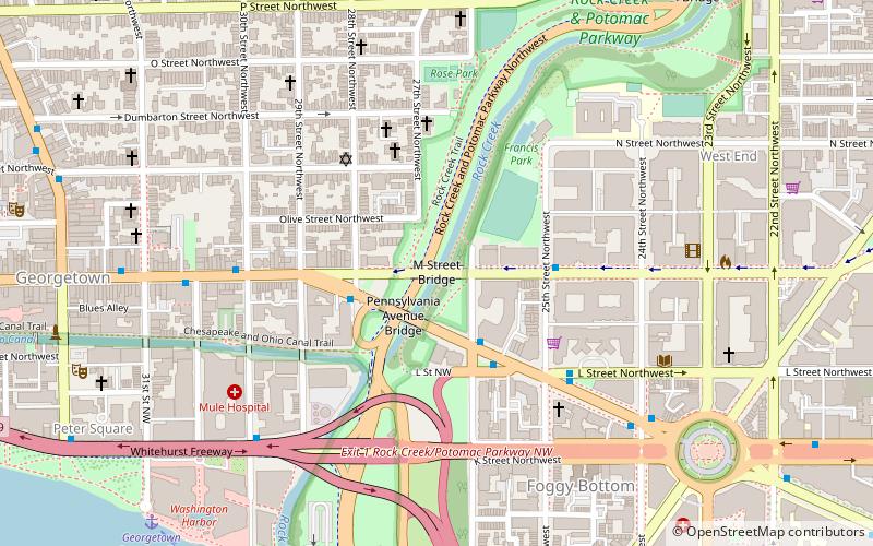
The M Street Bridge, also known as the M Street Overpass, carries M Street across Rock Creek and the Rock Creek and Potomac Parkway. It lies between the neighborhoods of Georgetown and Foggy Bottom in Northwest Washington, D.C. The non-arched design of the bridge contrasts with that of all the other bridges rising over the parkway. ()
Coordinates: 38°54'19"N, 77°3'20"W
Address
Northwest Washington (Foggy Bottom - GWU - West End)Washington D.C.
ContactAdd
Social media
Add
Getting there by public transportation
Public transportation stops near this location
- Metro
- Bus
 Metro
Metro
- Calculate routeFoggy Bottom–GWU 11 min walk
- Calculate routeDupont Circle 19 min walk
- Calculate routeMTA Bus Stop 18 min walk
- Calculate route21st St & F St Northwest 19 min walk
- Calculate route19th St & F St Northwest 22 min walk
- Calculate routeFlixBus Rosslyn 26 min walk
Day trips
M Street Bridge – popular in the area (distance from the attraction)
Nearby attractions include: Washington Harbour, Georgetown Park, Old Stone House, Chesapeake and Ohio Canal National Historical Park.


Frequently Asked Questions (FAQ)
Which popular attractions are close to M Street Bridge?
Nearby attractions include Pennsylvania Avenue Bridge, Washington D.C. (3 min walk), L Street Bridge, Washington D.C. (3 min walk), John Stoddert Haw House, Washington D.C. (4 min walk), Kesher Israel, Washington D.C. (4 min walk).
How to get to M Street Bridge by public transport?
The nearest stations to M Street Bridge:
Metro
Bus
Metro
- Foggy Bottom–GWU • Lines: Bl, Or, Sv (11 min walk)
- Dupont Circle • Lines: Rd (19 min walk)
Bus
- MTA Bus Stop • Lines: 305, 315 (18 min walk)
- 21st St & F St Northwest (19 min walk)