Cherrydale, Arlington
Map
Facts and practical information
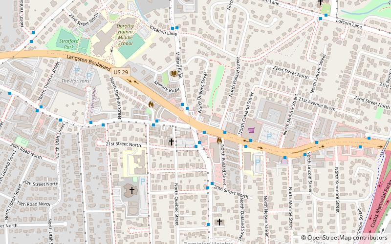
Cherrydale is a neighborhood in northern Arlington, Virginia. It is centered on the intersection known as the Five Points consisting of Quincy Street, Military Road, and Old Dominion Road being bisected by Lee Highway. Located in the community is the H-B Woodlawn school. One of the oldest nonresidential structures in the community is the Cherrydale Volunteer Fire House, built in 1919 to serve as the home of the Cherrydale Volunteer Fire Department. The department supplements the career staff who operate from the Arlington County Fire Department's Station 3, now located west of the Five Points intersection. ()
Coordinates: 38°53'49"N, 77°6'30"W
Address
North Arlington (Cherrydale)Arlington
ContactAdd
Social media
Add
Getting there by public transportation
Public transportation stops near this location
- Metro
- Bus
 Metro
Metro
- Calculate routeLee Hwy at N Quincy St 1 min walk
- Calculate routeMilitary Road at Old Dominion Dr 2 min walk
- Calculate routeN Quincy St at 21st St N 2 min walk
- Calculate routeVirginia Square–GMU 26 min walk
- Calculate routeClarendon 26 min walk
Day trips


Frequently Asked Questions (FAQ)
Which popular attractions are close to Cherrydale?
Nearby attractions include Ashton Heights Historic District, Arlington (5 min walk), Cherrydale Historic District, Arlington (5 min walk), Maywood Historic District, Arlington (10 min walk), Waverly Hills Historic District, Arlington (16 min walk).
How to get to Cherrydale by public transport?
The nearest stations to Cherrydale:
Bus
Metro
Bus
- Lee Hwy at N Quincy St • Lines: 55 (1 min walk)
- Military Road at Old Dominion Dr • Lines: 53A, 53B (2 min walk)
Metro
- Virginia Square–GMU • Lines: Or, Sv (26 min walk)
- Clarendon • Lines: Or, Sv (26 min walk)