Holy Comforter-St. Cyprian Catholic Church, Washington D.C.

Gallery (1)
Map
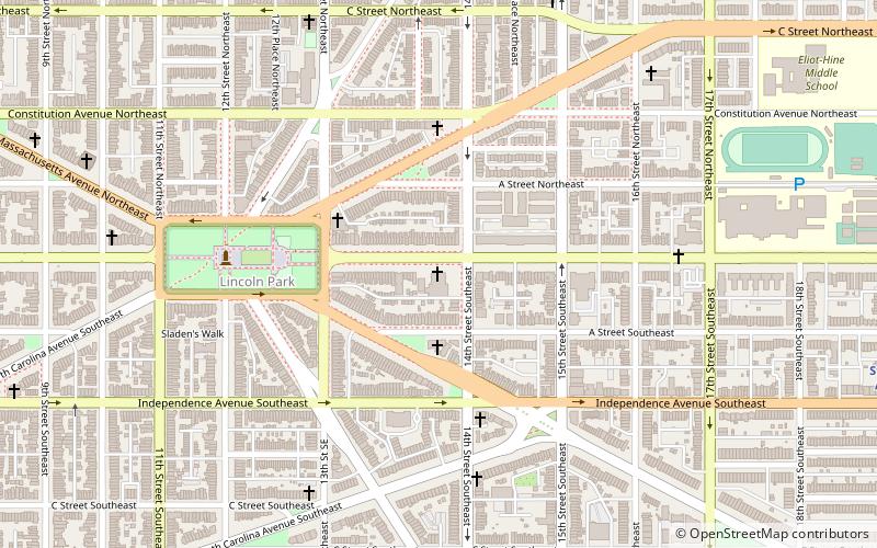
Map
Facts and practical information
Holy Comforter-St. Cyprian is a Black Catholic parish in Washington, D.C. established in 1966 by the merger of the predominately African-American St. Cyprian Catholic Church and the predominantly White Holy Comforter Catholic Church. ()
Coordinates: 38°53'22"N, 76°59'10"W
Address
Southeast Washington (Capitol Hill)Washington D.C.
ContactAdd
Social media
Add
Getting there by public transportation
Public transportation stops near this location
- Metro
- Bus
- Tram
- Train
 Metro
Metro
- Calculate routeStadium–Armory 14 min walk
- Calculate routePotomac Avenue 15 min walk
- Calculate routeBenning Road & 15th Street Northeast 19 min walk
- Calculate routeH Street & 8th Street Northeast 23 min walk
- Calculate routeHart 26 min walk
- Calculate routeDirksen 28 min walk
- Calculate routeRussell 30 min walk
- Calculate routeWashington Union Station 32 min walk
- Calculate routeFlixBus Washington Union Station 31 min walk
- Calculate routeM St SE & 4th St SE 31 min walk
- Calculate routeGreyhound 32 min walk
- Calculate routeWashington Deluxe Bus 33 min walk
Day trips


Frequently Asked Questions (FAQ)
Which popular attractions are close to Holy Comforter-St. Cyprian Catholic Church?
Nearby attractions include East Capitol Street Car Barn, Washington D.C. (3 min walk), Lincoln Park, Washington D.C. (4 min walk), East Capitol Street, Washington D.C. (13 min walk), Eastern Methodist Cemetery, Washington D.C. (14 min walk).
How to get to Holy Comforter-St. Cyprian Catholic Church by public transport?
The nearest stations to Holy Comforter-St. Cyprian Catholic Church:
Metro
Tram
Train
Bus
Metro
- Stadium–Armory • Lines: Bl, Or, Sv (14 min walk)
- Potomac Avenue • Lines: Bl, Or, Sv (15 min walk)
Tram
- Benning Road & 15th Street Northeast • Lines: H Street/Benning Road Streetcar (19 min walk)
- H Street & 8th Street Northeast • Lines: H Street/Benning Road Streetcar (23 min walk)
Train
- Hart (26 min walk)
- Dirksen (28 min walk)
Bus
- FlixBus Washington Union Station • Lines: 2601, 2602, 2668, N2610 (31 min walk)
- M St SE & 4th St SE • Lines: V4 (31 min walk)