Playland-Not-At-The-Beach, Berkeley
Map
Facts and practical information
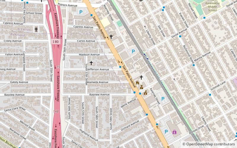
Playland-Not-At-The-Beach was a non-profit, family-oriented museum in El Cerrito, California celebrating America's bygone amusements, operated entirely by volunteers. ()
Established: 2000 (26 years ago)Coordinates: 37°55'0"N, 122°18'47"W
Getting there by public transportation
Public transportation stops near this location
- Metro
- Bus
 Metro
Metro
- Calculate routeSan Pablo Avenue & Jefferson Avenue 1 min walk
- Calculate routeEl Cerrito del Norte 16 min walk
Day trips


Frequently Asked Questions (FAQ)
How to get to Playland-Not-At-The-Beach by public transport?
The nearest stations to Playland-Not-At-The-Beach:
Bus
Metro
Bus
- San Pablo Avenue & Jefferson Avenue • Lines: 72, 72M, 800 (1 min walk)
Metro
- El Cerrito del Norte • Lines: Orange, Red (16 min walk)