West Philadelphia Elevated, Philadelphia
Map
Facts and practical information
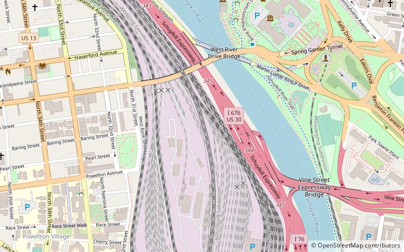
The West Philadelphia Elevated, also known as the High Line or Philadelphia High Line, is a railroad viaduct in the western part of Philadelphia, Pennsylvania. The 8,140-foot structure spans the railway lines of 30th Street Station, parallel to the main track of the station, in a north-south direction. The 1,045-foot long approach made of brick arches is the longest brick bridge and probably even the longest brick building in the United States. ()
Coordinates: 39°57'43"N, 75°11'4"W
Address
West Philadelphia (University City)Philadelphia
ContactAdd
Social media
Add
Getting there by public transportation
Public transportation stops near this location
- Metro
- Bus
- Tram
- Train
 Metro
Metro
- Calculate routeMegabus 11 min walk
- Calculate routeBolt Bus 11 min walk
- Calculate routeWalnut St & 23rd St 21 min walk
- Calculate routeMarket St & 39th St 23 min walk
- Calculate routePhiladelphia 30th Street Station 12 min walk
- Calculate routePenn Medicine 27 min walk
- Calculate routeSuburban Station 27 min walk
- Calculate route30th Street 13 min walk
- Calculate route34th Street 15 min walk
- Calculate route40th Street 26 min walk
- Calculate route15th Street 31 min walk
- Calculate route30th Street 13 min walk
- Calculate route33rd Street 14 min walk
- Calculate route36th Street & Lancaster Avenue 15 min walk
- Calculate routeLancaster Avenue & 36th Street 15 min walk
Maps SEPTA Regional Rail
SEPTA Regional RailDay trips
West Philadelphia Elevated – popular in the area (distance from the attraction)
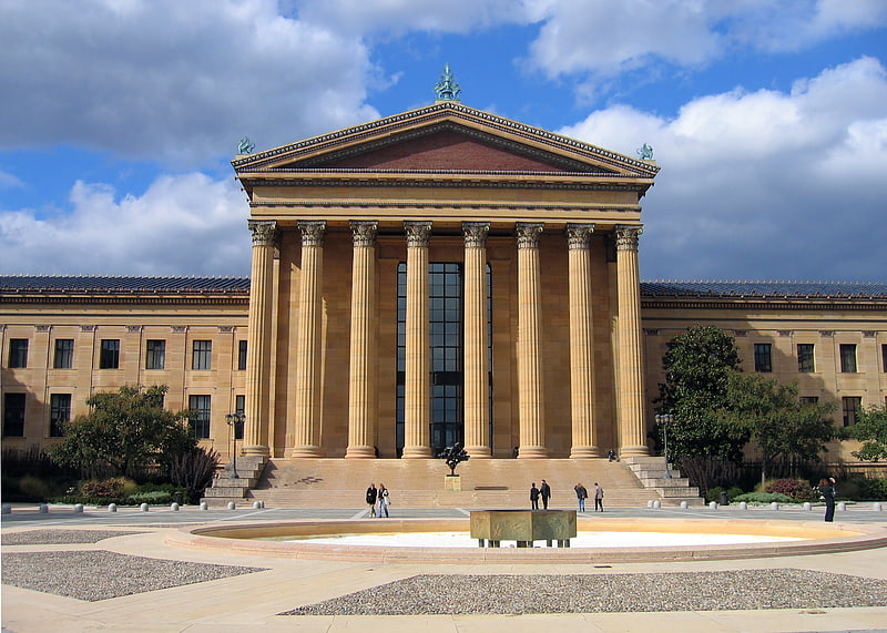
Nearby attractions include: Philadelphia Museum of Art, Fairmount Water Works, Spring Garden Street Bridge, Eakins Oval.


Frequently Asked Questions (FAQ)
Which popular attractions are close to West Philadelphia Elevated?
Nearby attractions include Colossus Bridge, Philadelphia (4 min walk), Spring Garden Street Bridge, Philadelphia (5 min walk), West River Drive Bridge, Philadelphia (5 min walk), Live 8 concert, Philadelphia (7 min walk).
How to get to West Philadelphia Elevated by public transport?
The nearest stations to West Philadelphia Elevated:
Bus
Train
Metro
Tram
Bus
- Megabus (11 min walk)
- Bolt Bus (11 min walk)
Train
- Philadelphia 30th Street Station (12 min walk)
- Penn Medicine (27 min walk)
Metro
- 30th Street • Lines: Mfl (13 min walk)
- 34th Street • Lines: Mfl (15 min walk)
Tram
- 30th Street • Lines: 10, 11, 13, 34, 36 (13 min walk)
- 33rd Street • Lines: 10, 11, 13, 34, 36 (14 min walk)