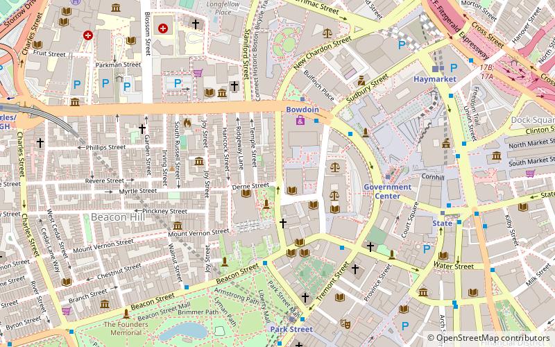
Bowdoin Street, Boston
Map
Facts and practical information
Bowdoin Street in Boston, Massachusetts extends from the top of Beacon Street, down Beacon Hill to Cambridge Street, near the West End. It was originally called "Middlecott Street" as early as the 1750s. In 1805 it was renamed after the Governor James Bowdoin. ()
Coordinates: 42°21'35"N, 71°3'46"W
Address
Beacon HillBoston
ContactAdd
Social media
Add
Getting there by public transportation
Public transportation stops near this location
- Metro
- Bus
- Light rail
- Train
 Metro
Metro
- Calculate routeBowdoin 4 min walk
- Calculate routeGovernment Center 5 min walk
- Calculate routePark Street 6 min walk
- Calculate routeState 8 min walk
- Calculate routeGovernment Center 5 min walk
- Calculate routePark Street 7 min walk
- Calculate routeHaymarket 8 min walk
- Calculate routeNorth Station 11 min walk
- Calculate routeTremont St opp Temple Pl 7 min walk
- Calculate routeOtis St @ Summer St 12 min walk
- Calculate routeFederal St @ Franklin St 12 min walk
- Calculate routeBoston North Station 12 min walk
- Calculate routeBoston South Station 18 min walk
- Calculate routeBoston Back Bay 27 min walk
Maps MBTA Subway
MBTA SubwayDay trips


Frequently Asked Questions (FAQ)
Which popular attractions are close to Bowdoin Street?
Nearby attractions include Massachusetts Law Enforcement Memorial, Boston (1 min walk), Temple Street Park, Boston (1 min walk), Mount Vernon Church, Boston (2 min walk), Beacon Hill Monument, Boston (2 min walk).
How to get to Bowdoin Street by public transport?
The nearest stations to Bowdoin Street:
Metro
Light rail
Bus
Train
Metro
- Bowdoin • Lines: Blue (4 min walk)
- Government Center • Lines: Blue (5 min walk)
Light rail
- Government Center • Lines: C, D, E (5 min walk)
- Park Street • Lines: B, C, D, E (7 min walk)
Bus
- Tremont St opp Temple Pl • Lines: 55 (7 min walk)
- Otis St @ Summer St • Lines: 504, 7 (12 min walk)
Train
- Boston North Station (12 min walk)
- Boston South Station (18 min walk)