Himmelfarb Health Sciences Library, Washington D.C.
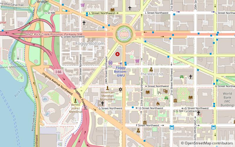
Map
Facts and practical information
The Himmelfarb Health Sciences Library was completed in 1973 during the presidency of Lloyd Elliott. The library serves the George Washington University School of Medicine and Health Sciences, the Milken Institute School of Public Health, and the George Washington University School of Nursing. The building is part of the Ross Hall Medical Complex, and has three floors above ground and one below ground. The library was named after Paul Himmelfarb. ()
Coordinates: 38°54'1"N, 77°3'2"W
Address
Northwest Washington (Foggy Bottom - GWU - West End)Washington D.C.
ContactAdd
Social media
Add
Getting there by public transportation
Public transportation stops near this location
- Metro
- Bus
 Metro
Metro
- Calculate routeFoggy Bottom–GWU 1 min walk
- Calculate routeFarragut West 15 min walk
- Calculate route21st St & F St Northwest 8 min walk
- Calculate routeMTA Bus Stop 11 min walk
- Calculate route19th St & F St Northwest 12 min walk
- Calculate routeFlixBus Rosslyn 29 min walk
Day trips
Himmelfarb Health Sciences Library – popular in the area (distance from the attraction)
Nearby attractions include: Georgetown Park, John F. Kennedy Center for the Performing Arts, Art Museum of the Americas, Blues Alley.


Frequently Asked Questions (FAQ)
Which popular attractions are close to Himmelfarb Health Sciences Library?
Nearby attractions include St. Mary's Episcopal Church, Washington D.C. (2 min walk), American Revolution Statuary, Washington D.C. (4 min walk), Gelman Library, Washington D.C. (4 min walk), Davita Gwu-K St, Washington D.C. (4 min walk).
How to get to Himmelfarb Health Sciences Library by public transport?
The nearest stations to Himmelfarb Health Sciences Library:
Metro
Bus
Metro
- Foggy Bottom–GWU • Lines: Bl, Or, Sv (1 min walk)
- Farragut West • Lines: Bl, Or, Sv (15 min walk)
Bus
- 21st St & F St Northwest (8 min walk)
- MTA Bus Stop • Lines: 305, 315 (11 min walk)