Nauck, Arlington
Map
Facts and practical information
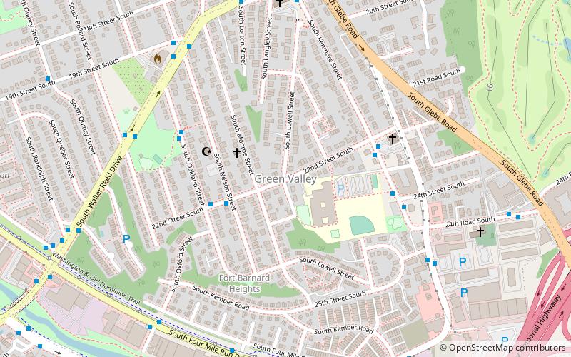
Nauck is a neighborhood in the southern part of Arlington County, Virginia, known locally as Green Valley. It is bordered by Four Mile Run and Shirlington to the south, Douglas Park to the west, I-395 to the east, and Columbia Heights and the Army-Navy Country Club to the north. The southeastern corner of the neighborhood borders the City of Alexandria. ()
Coordinates: 38°50'56"N, 77°5'17"W
Address
South Arlington (Nauck)Arlington
ContactAdd
Social media
Add
Getting there by public transportation
Public transportation stops near this location
- Bus
 Bus
Bus
- Calculate route22nd St S at S Lowell St 1 min walk
- Calculate routeS Kenmore St at 22nd St S 4 min walk
Day trips


Frequently Asked Questions (FAQ)
Which popular attractions are close to Nauck?
Nearby attractions include Lomax African Methodist Episcopal Zion Church, Arlington (9 min walk), Fort Richardson, Arlington (10 min walk), Our Lady Queen of Peace Catholic Church, Arlington (12 min walk), Washington and Old Dominion Railroad Regional Park, Alexandria (14 min walk).
How to get to Nauck by public transport?
The nearest stations to Nauck:
Bus
Bus
- 22nd St S at S Lowell St • Lines: 84 (1 min walk)
- S Kenmore St at 22nd St S • Lines: 23A, 23B, 23T, 84 (4 min walk)