Lincoln Boulevard, Omaha
Map
Facts and practical information
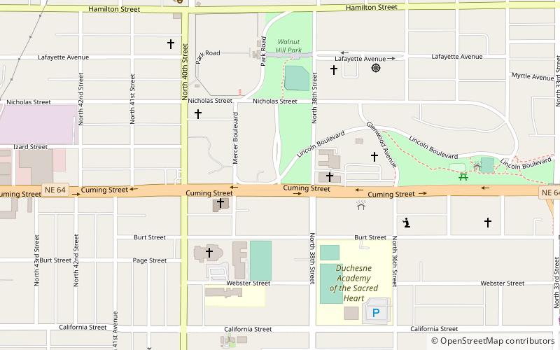
Lincoln Boulevard in Omaha, Nebraska was built in the early 1890s as part of the city's boulevard system under control of the Board of Park Commissioners. It runs through the Bemis Park neighborhood west-east from Mercer Boulevard to its end at North 29 Street; it then reemerges immediately north of Dodge Street, where it intersects with Turner Boulevard. ()
Coordinates: 41°16'6"N, 95°58'12"W
Address
Midtown (Bemis Park)Omaha
ContactAdd
Social media
Add
Getting there by public transportation
Public transportation stops near this location
- Bus
 Bus
Bus
- Calculate routePark Avenue & Douglas 26 min walk
- Calculate route24th & Cuming NW 30 min walk
- Calculate route50th & Dodge 32 min walk
- Calculate route30th & Harrison 33 min walk
Day trips


Frequently Asked Questions (FAQ)
Which popular attractions are close to Lincoln Boulevard?
Nearby attractions include Bemis Park Landmark Heritage District, Omaha (4 min walk), Lowe Avenue Presbyterian Church Omaha, Omaha (5 min walk), St. Cecilia Cathedral, Omaha (5 min walk), Nebraska Zen Center, Omaha (6 min walk).
How to get to Lincoln Boulevard by public transport?
The nearest stations to Lincoln Boulevard:
Bus
Bus
- Park Avenue & Douglas • Lines: 2 (26 min walk)
- 24th & Cuming NW • Lines: 24 (30 min walk)