Western Slope, Jersey City
Map
Facts and practical information
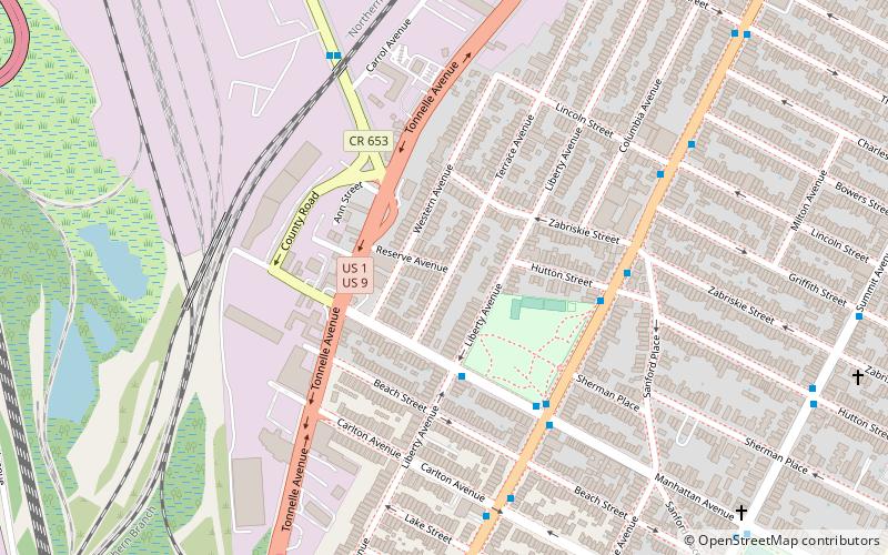
Western Slope is a neighborhood in The Heights, Jersey City, New Jersey on the cuesta, or gradual decline, of the western side of the New Jersey Palisades between The Boulevard and Tonnele Avenue. ()
Coordinates: 40°44'51"N, 74°3'35"W
Address
The HeightsJersey City
ContactAdd
Social media
Add
Getting there by public transportation
Public transportation stops near this location
- Metro
- Bus
- Light rail
- Train
 Metro
Metro
- Calculate routeJFK Boulevard at Hutton Street 5 min walk
- Calculate route2nd Street 25 min walk
- Calculate route9th Street–Congress Street 29 min walk
- Calculate routeJournal Square Transportation Center 28 min walk
- Calculate routeSecaucus Junction 33 min walk
Day trips


Frequently Asked Questions (FAQ)
Which popular attractions are close to Western Slope?
Nearby attractions include Saint Peter's Cemetery, Jersey City (13 min walk), Pershing Field, Jersey City (13 min walk), The Heights, Jersey City (13 min walk), Bergen Tunnels, Jersey City (14 min walk).
How to get to Western Slope by public transport?
The nearest stations to Western Slope:
Bus
Light rail
Metro
Train
Bus
- JFK Boulevard at Hutton Street • Lines: 125 (5 min walk)
Light rail
- 2nd Street • Lines: Hblr (25 min walk)
- 9th Street–Congress Street • Lines: Hblr (29 min walk)
Metro
- Journal Square Transportation Center • Lines: Jsq–33, JSQ–33 via HOB, Nwk–Wtc (28 min walk)
Train
- Secaucus Junction (33 min walk)