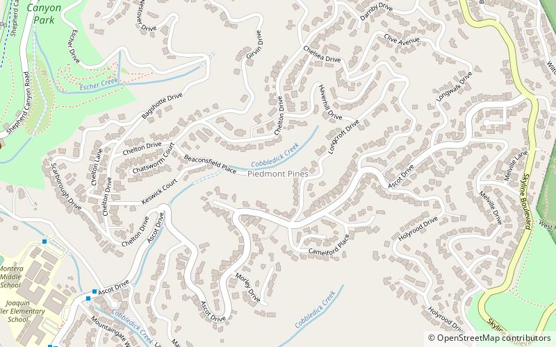
Piedmont Pines, Oakland
Map
Facts and practical information
Piedmont Pines is an affluent residential neighborhood in the hills of Oakland, California. It is generally bounded by Highway 13 to the west, Shepherd Canyon Rd. to the north, Skyline Blvd. to the east, and Joaquin Miller Park to the south. ()
Coordinates: 37°49'22"N, 122°11'41"W
Address
North Hills (Piedmont Pines)Oakland
ContactAdd
Social media
Add
Getting there by public transportation
Public transportation stops near this location
- Bus
 Bus
Bus
- Calculate routeMountain Boulevard & Snake Road 20 min walk
- Calculate routeJoaquin Miller Road & Mountain Boulevard 22 min walk
Day trips


Frequently Asked Questions (FAQ)
Which popular attractions are close to Piedmont Pines?
Nearby attractions include Chabot Space and Science Center, Oakland (21 min walk), Joaquin Miller Park, Oakland (22 min walk), Joaquin Miller House, Oakland (22 min walk).
How to get to Piedmont Pines by public transport?
The nearest stations to Piedmont Pines:
Bus
Bus
- Mountain Boulevard & Snake Road • Lines: 33 (20 min walk)
- Joaquin Miller Road & Mountain Boulevard • Lines: 339 (22 min walk)