Iron Triangle, Richmond
Map
Facts and practical information
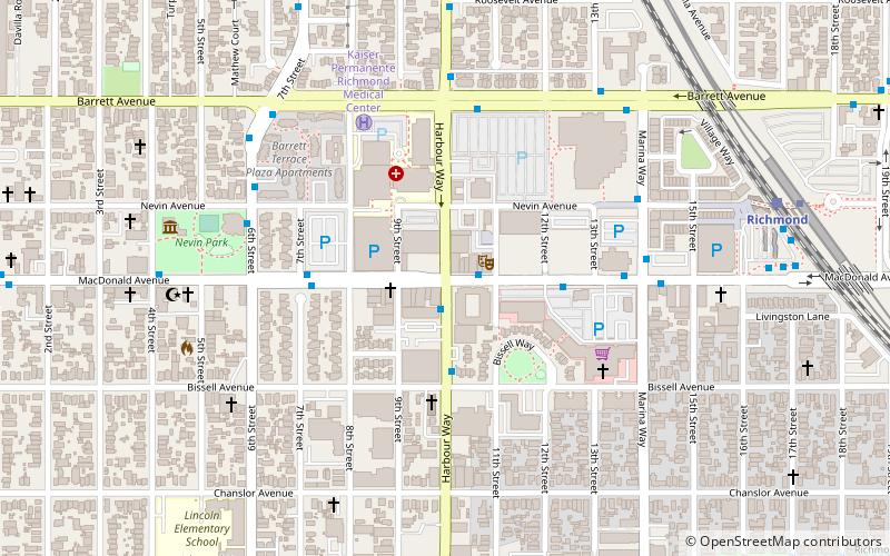
The Iron Triangle, sometimes known as Central Richmond, is a neighborhood in Richmond, California. It is a largely residential area but includes the downtown Richmond business district along Macdonald Avenue. Commercial areas on Cutting Boulevard and near Interstate 580 are also in the neighborhood if the more extensive of two possible definitions of its area is used. ()
Coordinates: 37°56'9"N, 122°21'36"W
Address
Iron TriangleRichmond
ContactAdd
Social media
Add
Getting there by public transportation
Public transportation stops near this location
- Metro
- Bus
- Train
 Metro
Metro
- Calculate routeHarbour Way & MacDonald Avenue 1 min walk
- Calculate routeMacDonald Avenue & 11th Street 1 min walk
- Calculate routeRichmond 10 min walk
- Calculate routeRichmond 10 min walk
Day trips


Frequently Asked Questions (FAQ)
Which popular attractions are close to Iron Triangle?
Nearby attractions include Benoit-Casper Brewing, Richmond (13 min walk), Atchison Village, Richmond (16 min walk).
How to get to Iron Triangle by public transport?
The nearest stations to Iron Triangle:
Bus
Train
Metro
Bus
- Harbour Way & MacDonald Avenue • Lines: 76 (1 min walk)
- MacDonald Avenue & 11th Street • Lines: 376, 72M, 76 (1 min walk)
Train
- Richmond (10 min walk)
Metro
- Richmond • Lines: Orange, Red (10 min walk)