Myrtle Avenue, New York City
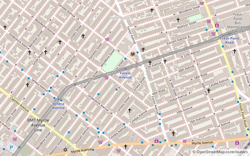
Map
Facts and practical information
Myrtle Avenue is a 8.1-mile-long street that runs from Duffield Street in Downtown Brooklyn to Jamaica Avenue in Richmond Hill, Queens, in New York City, United States. ()
Coordinates: 40°42'14"N, 73°54'11"W
Address
Northwestern Queens (Ridgewood)New York City
ContactAdd
Social media
Add
Getting there by public transportation
Public transportation stops near this location
- Metro
- Bus
 Metro
Metro
- Calculate routeForest Avenue 1 min walk
- Calculate routeSeneca Avenue 7 min walk
- Calculate routePutnam Avenue & Woodward Avenue 2 min walk
- Calculate routeMadison Street & Oneronk Avenue 3 min walk
Maps SubwayMaps
 Manhattan Buses
SubwayMapsManhattan BusesDay trips


Frequently Asked Questions (FAQ)
Which popular attractions are close to Myrtle Avenue?
Nearby attractions include St. Matthias Roman Catholic Church, New York City (4 min walk), Ridgewood, New York City (4 min walk), St. Mary & St. Antonios Coptic Orthodox Church, New York City (8 min walk), Famous Accountants, New York City (11 min walk).
How to get to Myrtle Avenue by public transport?
The nearest stations to Myrtle Avenue:
Metro
Bus
Metro
- Forest Avenue • Lines: M (1 min walk)
- Seneca Avenue • Lines: M (7 min walk)
Bus
- Putnam Avenue & Woodward Avenue • Lines: Q58 (2 min walk)
- Madison Street & Oneronk Avenue • Lines: Q58 (3 min walk)