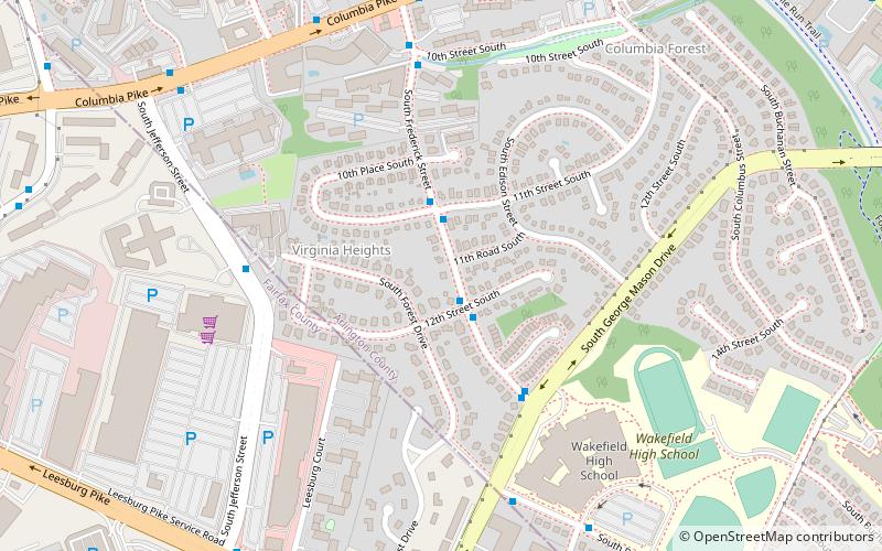
Virginia Heights Historic District, Arlington

Facts and practical information
The Virginia Heights Historic District is a national historic district located at Arlington County, Virginia. It is directly west of the Columbia Forest Historic District. It contains 117 contributing buildings in a residential neighborhood in southwestern Arlington. The area was developed between 1946 and 1952, and consists of four small subdivisions of Section Four of Columbia Forest, High Point, Virginia Heights, and Frederick Hill. The dwelling styles include Colonial Revival style houses and Modernist twin dwellings designed by noted local architect Charles M. Goodman. In addition, five single dwellings in Virginia Heights are known to be prefabricated houses, three of which are Lustron houses. ()
South Arlington (Columbia Forest)Arlington
- Bus
 Bus
Bus
- Calculate routeS Frederick St at 12th St S 2 min walk


Frequently Asked Questions (FAQ)
Which popular attractions are close to Virginia Heights Historic District?
How to get to Virginia Heights Historic District by public transport?
Bus
- S Frederick St at 12th St S • Lines: 75 (2 min walk)