Tyler Park, Louisville

Gallery (1)
Map
Map
Facts and practical information
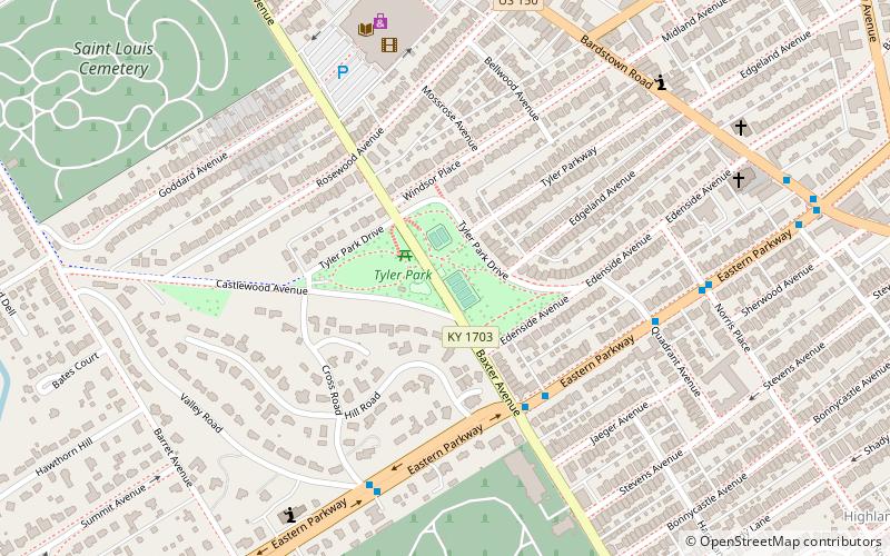
Tyler Park is a neighborhood three miles southeast of downtown Louisville, Kentucky, USA. It is considered a part of a larger area of Louisville called The Highlands. Near the middle of the neighborhood is a city park of the same name, and many houses in the neighborhood feature park views. The neighborhood boundaries are St Louis Cemetery to the north, Bardstown Road to the east, Eastern Parkway to the south and Beargrass Creek to the west. ()
Coordinates: 38°13'51"N, 85°42'60"W
Address
The Highlands (Tyler Park)Louisville
ContactAdd
Social media
Add
Getting there by public transportation
Public transportation stops near this location
- Bus
 Bus
Bus
- Calculate routeEastern Parkway / Baxter 5 min walk
Day trips


Frequently Asked Questions (FAQ)
Which popular attractions are close to Tyler Park?
Nearby attractions include St. James Catholic Church, Louisville (9 min walk), Cherokee Triangle, Louisville (10 min walk), John B. Castleman Monument, Louisville (10 min walk), The Highlands, Louisville (14 min walk).
How to get to Tyler Park by public transport?
The nearest stations to Tyler Park:
Bus
Bus
- Eastern Parkway / Baxter • Lines: 29East Bardstown Rd, 29East Oxmoor, 29West Bardstown Rd, 29West Oxmoor (5 min walk)