Walnut Hills, Dayton

Map
Facts and practical information
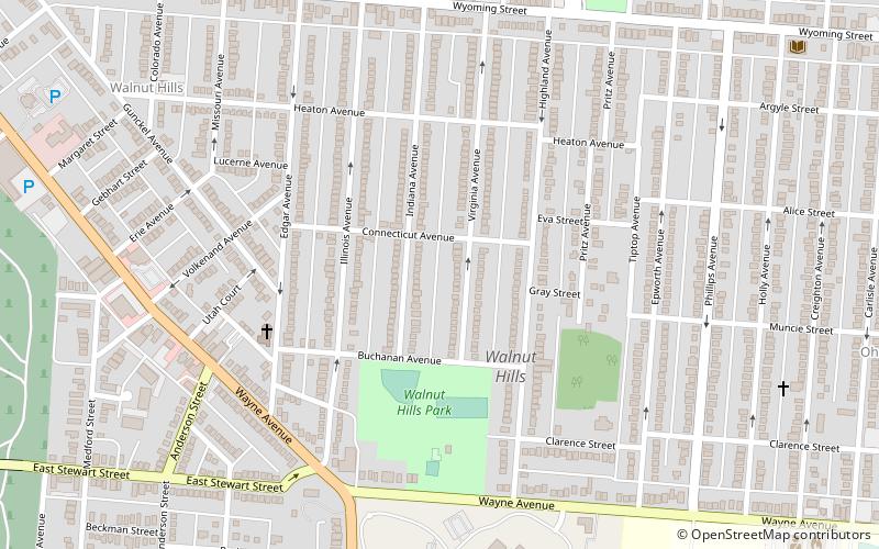
Walnut Hills is a neighborhood in Dayton, Ohio, United States. It is roughly bounded by Wayne Avenue to the south, Pursell Avenue to the east, Wyoming Street to the north, and Woodland Cemetery to the west. Walnut Hills borders the neighborhoods of Twin Towers and Linden Heights to the north, Hearthstone to the east, and Belmont to the south. ()
Coordinates: 39°44'34"N, 84°9'40"W
Address
Walnut HillsDayton
ContactAdd
Social media
Add
Day trips
Walnut Hills – popular in the area (distance from the attraction)
Nearby attractions include: Woodland Cemetery and Arboretum, St. Mary's Catholic Church, Patterson Homestead, Islamic Society of Greater Dayton.
Frequently Asked Questions (FAQ)
Which popular attractions are close to Walnut Hills?
Nearby attractions include Southern Ohio Lunatic Asylum, Dayton (9 min walk), Woodland Cemetery and Arboretum, Dayton (17 min walk), St. Mary's Catholic Church, Dayton (21 min walk), University of Dayton, Dayton (22 min walk).


