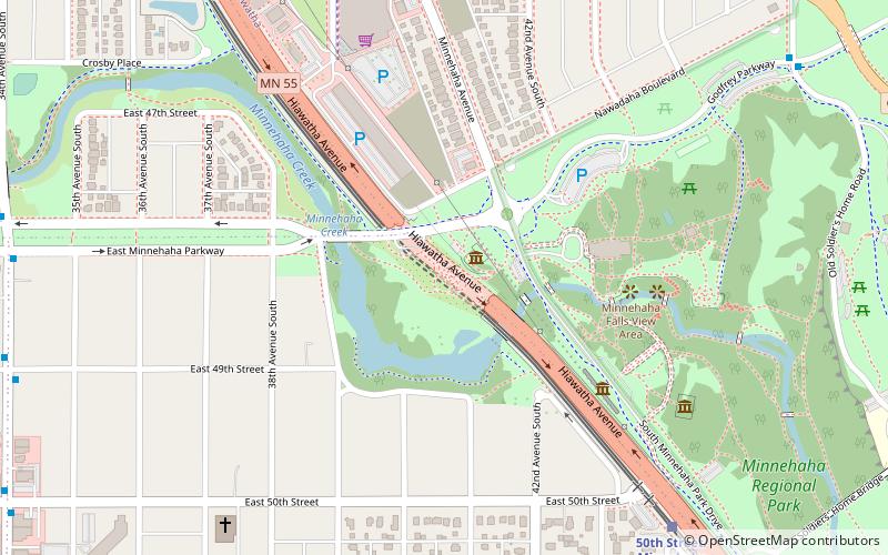
Longfellow Gardens, Minneapolis
Facts and practical information
Nestled within the verdant embrace of Minneapolis, Longfellow Gardens presents a serene escape from the urban bustle, offering a tranquil haven for both residents and visitors alike. While not a zoo in the traditional sense, this garden provides a naturalistic setting that harmonizes with the adjacent Longfellow Zoo, a historic feature that once graced the city.
Longfellow Gardens is an emblem of horticultural beauty in Minneapolis. Established as part of the city's commitment to green spaces, it is a living tableau that showcases a diverse array of plant species, with meticulously curated flower beds and lush landscapes that change with the seasons. Visitors to the gardens can immerse themselves in the splendor of blooming flora, which provides a picturesque backdrop for leisurely strolls or reflective moments.
The gardens have been thoughtfully designed to create an interactive experience with nature. Educational signage and programs are often available to enlighten guests about the local ecosystem and the importance of conservation. This commitment to education once echoed the mission of the historic Longfellow Zoo, which served as an educational and recreational facility for decades before closing its doors.
Today, Longfellow Gardens stands as a testament to the city's dedication to preserving green spaces and fostering a connection with nature. While the echoes of the zoo's past linger in the collective memory of the community, the gardens have blossomed into a beloved destination in their own right.
Nokomis (Minnehaha)Minneapolis
- Bus
- Light rail
 Bus
Bus
- Calculate route46th Street & Minnehaha Avenue 8 min walk
- Calculate routeGate A 13 min walk
- Calculate routeFord Parkway & Woodlawn Avenue 23 min walk
- Calculate route50th Street/Minnehaha Park 9 min walk
- Calculate route46th Street 12 min walk
- Calculate routeVA Medical Center 27 min walk


Frequently Asked Questions (FAQ)
Which popular attractions are close to Longfellow Gardens?
How to get to Longfellow Gardens by public transport?
Bus
- 46th Street & Minnehaha Avenue • Lines: A (8 min walk)
- Gate A • Lines: A (13 min walk)
Light rail
- 50th Street/Minnehaha Park • Lines: 901 (9 min walk)
- 46th Street • Lines: 901 (12 min walk)