Franklin Square Historic District, Baltimore

Gallery (1)
Map
Map
Facts and practical information
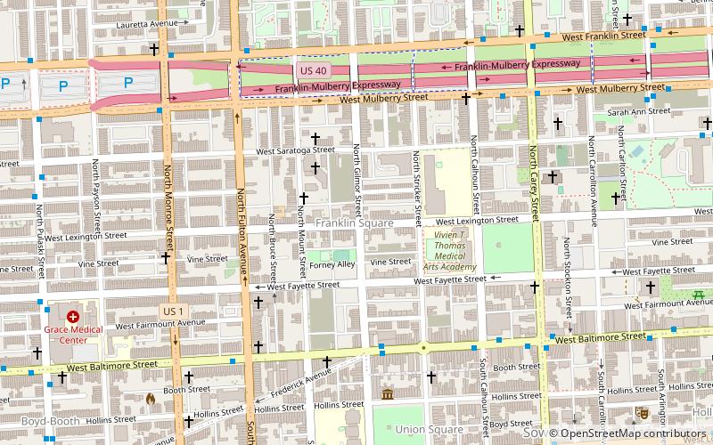
Franklin Square Historic District is a national historic district in Baltimore, Maryland, United States. It is a 19th-century rowhouse neighborhood developed along a strict grid street pattern. A one square block, two and a half acre public park, Franklin Square, is a focal point for the area and the most elaborate rowhousing surrounds the square. The district contains approximately 1,300 buildings of which approximately 1,250 contribute to the significance of the historic district. ()
Coordinates: 39°17'27"N, 76°38'33"W
Address
Western Baltimore (Franklin Square)Baltimore
ContactAdd
Social media
Add
Getting there by public transportation
Public transportation stops near this location
- Metro
- Bus
- Train
 Metro
Metro
- Calculate routeHollins Market 11 min walk
- Calculate routeWest Baltimore 14 min walk
- Calculate routeMount Clare Street 14 min walk
- Calculate routeUMB Biopark Garage 15 min walk
- Calculate routeWest Baltimore 16 min walk
- Calculate routeUpton–Avenue Market 26 min walk
- Calculate routeLexington Market 30 min walk
- Calculate routeState Center/Cultural Center 33 min walk
Day trips


Frequently Asked Questions (FAQ)
Which popular attractions are close to Franklin Square Historic District?
Nearby attractions include H. L. Mencken House, Baltimore (6 min walk), St. Luke's Church, Baltimore (6 min walk), Hollins Market, Baltimore (8 min walk), Sowebo, Baltimore (9 min walk).
How to get to Franklin Square Historic District by public transport?
The nearest stations to Franklin Square Historic District:
Bus
Train
Metro
Bus
- Hollins Market • Lines: Orange (11 min walk)
- West Baltimore • Lines: 77, 78, Or, Pk (14 min walk)
Train
- West Baltimore (16 min walk)
Metro
- Upton–Avenue Market • Lines: M (26 min walk)
- Lexington Market • Lines: M (30 min walk)