Eire Pub, Boston
Map
Facts and practical information
The Eire Pub is an Irish pub in Dorchester, Massachusetts. ()
Coordinates: 42°16'59"N, 71°3'22"W
Address
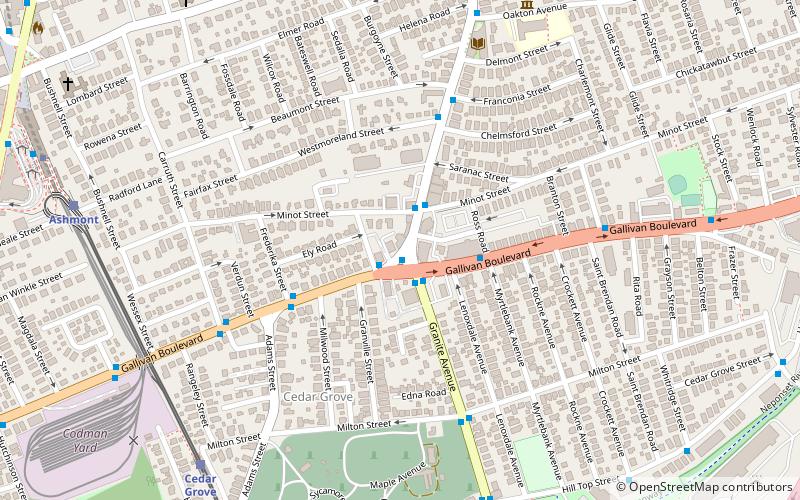
795 Adams StDorchester (Ashmont)Boston
Contact
+1 617-436-0088
Social media
Add
Getting there by public transportation
Public transportation stops near this location
- Metro
- Bus
- Light rail
- Train
 Metro
Metro
- Calculate routeCedar Grove 9 min walk
- Calculate routeAshmont/Peabody Square 10 min walk
- Calculate routeButler 21 min walk
- Calculate routeMilton 27 min walk
- Calculate routeAshmont/Peabody Square 11 min walk
- Calculate routeShawmut 22 min walk
- Calculate routeFields Corner 31 min walk
- Calculate route240 11 min walk
- Calculate route23 11 min walk
- Calculate routeDorchester Ave @ Van Winkle St 13 min walk
- Calculate routeDorchester Ave @ Hurlcroft Ave 13 min walk
- Calculate routeTalbot Avenue 35 min walk
Maps MBTA Subway
MBTA SubwayDay trips


Frequently Asked Questions (FAQ)
Which popular attractions are close to Eire Pub?
Nearby attractions include Pierce House, Boston (9 min walk), The Peabody, Boston (12 min walk), Ashmont, Boston (13 min walk), Parish of All Saints Ashmont, Boston (13 min walk).
How to get to Eire Pub by public transport?
The nearest stations to Eire Pub:
Light rail
Metro
Bus
Train
Light rail
- Cedar Grove • Lines: M (9 min walk)
- Ashmont/Peabody Square • Lines: M (10 min walk)
Metro
- Ashmont/Peabody Square • Lines: Red (11 min walk)
- Shawmut • Lines: Red (22 min walk)
Bus
- 240 • Lines: 240, 240 inbound, 240 outbound, 240-1 inbound, 240-1 outbound, 240-9 inbound, 240-9 outbound (11 min walk)
- 23 • Lines: 23 (11 min walk)
Train
- Talbot Avenue (35 min walk)