Dorchester Park, Boston
Map

Map

Facts and practical information
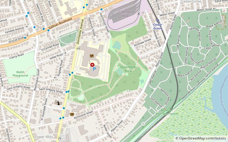
Dorchester Park is a historic park bounded by Dorchester Avenue, Richmond, Adams and Richview Streets in the Dorchester neighborhood of Boston, Massachusetts. ()
Elevation: 59 ft a.s.l.Coordinates: 42°16'36"N, 71°3'49"W
Address
Dorchester (Lower East Mills - Cedar Grove)Boston
ContactAdd
Social media
Add
Day trips
Dorchester Park – popular in the area (distance from the attraction)
Nearby attractions include: Captain Robert Bennet Forbes House, Parish of All Saints Ashmont, Pierce House, Second Church of Dorchester.
Frequently Asked Questions (FAQ)
Which popular attractions are close to Dorchester Park?
Nearby attractions include Dorchester South Burying Ground, Boston (6 min walk), Lower Mills, Boston (10 min walk), The Peabody, Boston (17 min walk), Ashmont, Boston (17 min walk).
How to get to Dorchester Park by public transport?
The nearest stations to Dorchester Park:
Bus
Light rail
Metro
Train
Bus
- Opp 2165 Dorchester Ave • Lines: 240, 240 inbound, 240-1 inbound, 240-9 inbound (5 min walk)
- 2165 Dorchester Ave • Lines: 240 outbound, 240-1 outbound, 240-9 outbound (5 min walk)
Light rail
- Cedar Grove • Lines: M (7 min walk)
- Butler • Lines: M (8 min walk)
Metro
- Ashmont/Peabody Square • Lines: Red (14 min walk)
- Shawmut • Lines: Red (29 min walk)
Train
- Morton Street (30 min walk)
- Talbot Avenue (36 min walk)

 MBTA Subway


