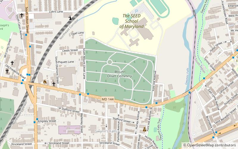
Mount Olivet Cemetery, Baltimore
Map
Facts and practical information
Mount Olivet Cemetery in western Baltimore, Maryland is a historic burial ground dating back into the middle 1800s, known as "The Resting Place of Methodist Bishops." ()
Coordinates: 39°16'53"N, 76°39'56"W
Getting there by public transportation
Public transportation stops near this location
- Bus
- Train
 Bus
Bus
- Calculate routeWest Baltimore 27 min walk
- Calculate routeWest Baltimore 28 min walk
Day trips


Frequently Asked Questions (FAQ)
Which popular attractions are close to Mount Olivet Cemetery?
Nearby attractions include Gwynns Falls, Baltimore (8 min walk), Loudon Park National Cemetery, Baltimore (13 min walk), Saint Agnes, Baltimore (18 min walk), Carrollton Viaduct, Baltimore (19 min walk).
How to get to Mount Olivet Cemetery by public transport?
The nearest stations to Mount Olivet Cemetery:
Train
Bus
Train
- West Baltimore (27 min walk)
Bus
- West Baltimore • Lines: 77, 78, Or, Pk (28 min walk)