Wattle Park, Melbourne

Gallery (3)
Map
Map
Gallery
Facts and practical information
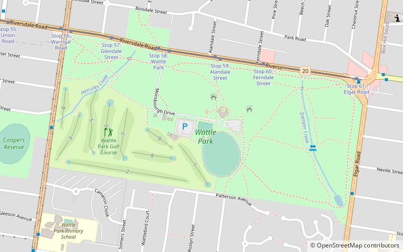
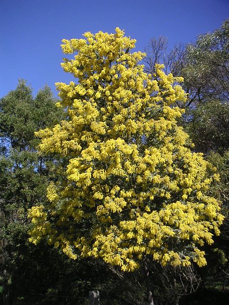
Wattle Park is a public park in Melbourne, Australia, located in the suburb of Burwood. It is known for its plantation of 12,000 wattle trees. It is currently maintained by Parks Victoria. The park provides public open space for recreation, as well as sporting facilities and a wedding and function venue. ()
Opened: 31 March 1917 (108 years ago)Elevation: 358 ft a.s.l.Coordinates: 37°50'21"S, 145°6'14"E
Address
1012 Riversdale RoadWhitehorse (Burwood)Melbourne 2004
Contact
+61 13 19 63
Social media
Add
Getting there by public transportation
Public transportation stops near this location
- Bus
- Tram
- Train
 Bus
Bus
- Calculate routeStop 59: Alandale Street 5 min walk
- Calculate routeStop 58: Wattle Park 6 min walk
- Calculate routeStop 60: Ferndale Street 6 min walk
- Calculate routeStop 57: Glendale Street 8 min walk
- Calculate routeRiversdale Road 14 min walk
- Calculate routeElgar Road 12 min walk
- Calculate routeSurrey Hills 28 min walk
- Calculate routeChatham 34 min walk
Maps Melbourne TramsMaps
 Victoria Trains
Melbourne TramsMapsVictoria TrainsDay trips


Frequently Asked Questions (FAQ)
How to get to Wattle Park by public transport?
The nearest stations to Wattle Park:
Tram
Bus
Train
Tram
- Stop 59: Alandale Street • Lines: 70, 70d (5 min walk)
- Stop 58: Wattle Park • Lines: 70, 70d (6 min walk)
Bus
- Riversdale Road • Lines: 766, 767 (14 min walk)
- Elgar Road • Lines: 903, Bus 903 (12 min walk)
Train
- Surrey Hills (28 min walk)
- Chatham (34 min walk)