The Block, Sydney
Map
Facts and practical information
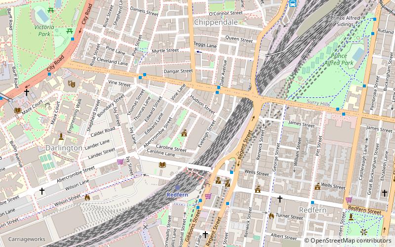
The Block is a colloquial but universally applied name given to a residential block of social housing in the suburb of Redfern, Sydney, bound by Eveleigh, Caroline, Louis and Vine Streets. Beginning in 1973, houses on this block were purchased over a period of 30 years by the Aboriginal Housing Company for use as a project in Aboriginal-managed housing. ()
Coordinates: 33°53'24"S, 151°11'56"E
Address
South Sydney (Darlington)Sydney
ContactAdd
Social media
Add
Getting there by public transportation
Public transportation stops near this location
- Bus
- Light rail
- Train
 Bus
Bus
- Calculate routeRedfern 5 min walk
- Calculate routeCentral 14 min walk
- Calculate routeMacdonaldtown 23 min walk
- Calculate routeErskineville 27 min walk
- Calculate routeBroadway at Buckland Street 11 min walk
- Calculate routeUniversity of Technology Sydney, Broadway 11 min walk
- Calculate routeStand N, Central Station, Railway Square 13 min walk
- Calculate routeCentral Chalmers Street 17 min walk
- Calculate routeCentral 18 min walk
- Calculate routeHaymarket 18 min walk
- Calculate routeSurry Hills 19 min walk
Maps Sydney TrainsMaps
 Sydney Light RailMaps
 Sydney Ferries
Sydney TrainsMapsSydney Light RailMapsSydney FerriesDay trips


Frequently Asked Questions (FAQ)
Which popular attractions are close to The Block?
Nearby attractions include Chippendale Cellars, Sydney (4 min walk), St Andrew's Greek Orthodox Theological College, Sydney (6 min walk), Cathedral of the Annunciation of Our Lady, Sydney (6 min walk), Balfour Street Park, Sydney (6 min walk).
How to get to The Block by public transport?
The nearest stations to The Block:
Train
Bus
Light rail
Train
- Redfern (5 min walk)
- Central (14 min walk)
Bus
- Broadway at Buckland Street • Lines: 431, 433 (11 min walk)
- University of Technology Sydney, Broadway • Lines: 431, 433, 438 (11 min walk)
Light rail
- Central Chalmers Street • Lines: L2, L3 (17 min walk)
- Central • Lines: L1 (18 min walk)