Redfern Park, Sydney

Facts and practical information
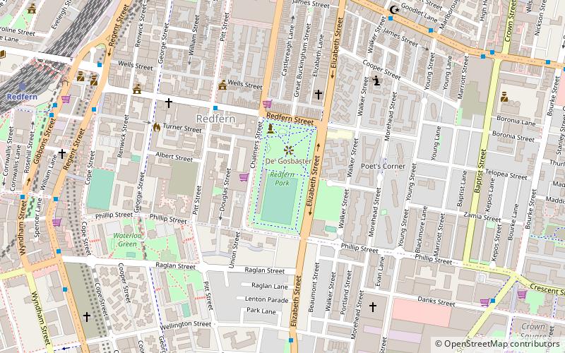
Redfern Park, nestled in the heart of Redfern, a suburb located just a stone's throw from Sydney's bustling Central Business District, is an urban oasis rich in cultural and historical significance. This charming park serves as a verdant retreat for locals and tourists alike, offering a tranquil respite from the city's frenetic pace.
The park itself is a picturesque space, blending well-maintained lawns, shady trees, and colorful flower beds to create an inviting environment for relaxation and recreation. It's a perfect spot for a leisurely picnic, a casual stroll, or simply to sit and watch the world go by. For the more active visitors, Redfern Park provides ample space for jogging and a children's playground that keeps the young ones entertained.
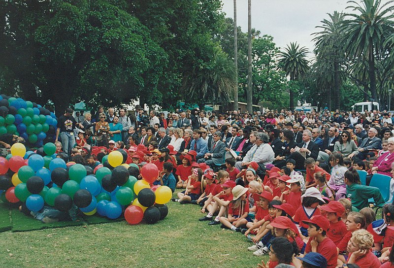
Redfern Park is not just about natural beauty; it also plays a pivotal role in the social and cultural tapestry of the area. It has been a focal point for community gatherings and events, reflecting the diverse and vibrant character of Redfern's population. The park's history is deeply intertwined with the local Aboriginal community, and it was here in 2008 where then-Prime Minister Kevin Rudd delivered the National Apology to Australia's Indigenous Peoples, making it a site of profound national significance.
South Sydney (Redfern)Sydney
- Bus
- Light rail
- Train
 Bus
Bus
- Calculate routeSurry Hills, Cleveland Street nr Crown Street 11 min walk
- Calculate routeBourke Street Nr Phillip Street, Waterloo 11 min walk
- Calculate routeStand N, Central Station, Railway Square 19 min walk
- Calculate routeStand M, Central Station, Railway Square 20 min walk
- Calculate routeRedfern 12 min walk
- Calculate routeCentral 19 min walk
- Calculate routeGreen Square 22 min walk
- Calculate routeMacdonaldtown 30 min walk
- Calculate routeSurry Hills 15 min walk
- Calculate routeCentral Chalmers Street 19 min walk
- Calculate routeCentral 22 min walk
- Calculate routeMoore Park 24 min walk
 Sydney TrainsMaps
 Sydney Light RailMaps
 Sydney Ferries


Frequently Asked Questions (FAQ)
Which popular attractions are close to Redfern Park?
How to get to Redfern Park by public transport?
Bus
- Surry Hills, Cleveland Street nr Crown Street • Lines: 301 (11 min walk)
- Bourke Street Nr Phillip Street, Waterloo • Lines: 301 (11 min walk)
Train
- Redfern (12 min walk)
- Central (19 min walk)
Light rail
- Surry Hills • Lines: L2, L3 (15 min walk)
- Central Chalmers Street • Lines: L2, L3 (19 min walk)