Edgars Creek Trail, Melbourne
Map
Facts and practical information
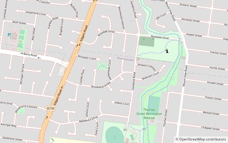
The Edgars Creek Trail is a shared use path for cyclists and pedestrians in the suburb of Thomastown, an inner northern suburb of Melbourne, Victoria. ()
Coordinates: 37°40'22"S, 145°0'18"E
Address
Whittlesea (Thomastown)Melbourne
ContactAdd
Social media
Add
Getting there by public transportation
Public transportation stops near this location
- Bus
- Train
 Bus
Bus
- Calculate routeTravers Street/High Street 14 min walk
- Calculate routeWestall Street/High Street 15 min walk
- Calculate routeHowell Street/High Street 15 min walk
- Calculate routeThomastown Station/Station St 19 min walk
- Calculate routeThomastown 19 min walk
- Calculate routeLalor 21 min walk
Maps Melbourne TramsMaps
 Victoria Trains
Melbourne TramsMapsVictoria TrainsDay trips


Frequently Asked Questions (FAQ)
How to get to Edgars Creek Trail by public transport?
The nearest stations to Edgars Creek Trail:
Bus
Train
Bus
- Travers Street/High Street • Lines: 555, 557 (14 min walk)
- Westall Street/High Street • Lines: 555, 557 (15 min walk)
Train
- Thomastown (19 min walk)
- Lalor (21 min walk)