Traualpsee
#237 among destinations in Austria

Facts and practical information
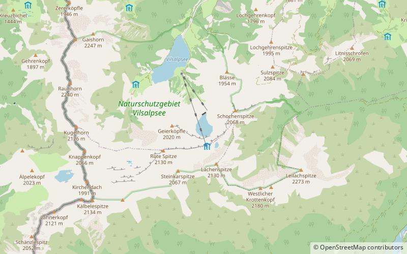
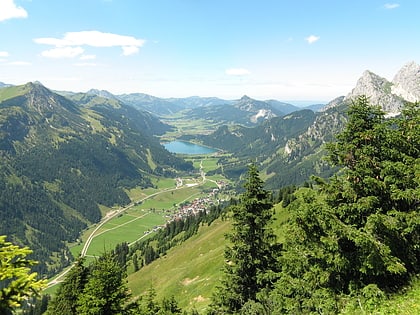
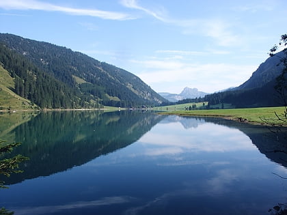
Traualpsee is a lake of Tyrol, Austria. ()
TyrolAustria
Traualpsee plan & book
Unleash the traveler in you — discover the cheapest flight deals, find the perfect hotel or hostel nearby, and search for the best car rental prices. Travel at your own pace to discover new places and enjoy your journey.
Traualpsee – popular in the area (distance from the attraction)
Nearby attractions include: Tannheimer Tal, Hochvogel, Vilsalpsee, Rote Flüh.
 Winter sport, Ski area
Tannheimer Tal
95 min walk • Nestled in the heart of the Austrian Alps, Tannheimer Tal is a picturesque ski area that beckons winter sports enthusiasts from around the globe. Known for its breathtaking scenery and exceptional skiing conditions, this valley offers a serene escape into a world of...
 Nature, Natural attraction, Mountain
Hochvogel
151 min walk • Nestled within the breathtaking alpine landscape of Austria, the Hochvogel stands as a towering testament to nature's grandeur. This majestic mountain, part of the Allgäu Alps, rises to an impressive height of 2,592 meters, dominating the surrounding terrain with its...
 Nature, Natural attraction, Mountain
Rote Flüh
145 min walk • For the "Rote Flüh" feature on the North Face of the Eiger, see Eiger. The Rote Flüh is a peak in the Tannheim Mountains, a sub-range of the Allgäu Alps. It is 2,108 metres high. The Rote Flüh is built from Wetterstein limestone.
 Nature, Natural attraction, Mountain
Leilachspitze
43 min walk • The Leilachspitze in the Allgäu Alps is a mountain, 2,274 m, and the highest peak in the Vilsalpsee Mountains. It lies within the Austrian state of Tyrol.
 Scenic alpine lake for swimming and hiking
Haldensee
107 min walk • Haldensee is a lake of Tyrol, Austria. It is located on an altitude of 1124 m ü. A. in the Tannheimer Tal between Grän and Nesselwängle and has a size of 73 hectares.
 Nature, Natural attraction, Mountain
Gimpel Mountain
151 min walk • The Gimpel is a peak in the Tannheim Mountains, a sub-range of the Allgäu Alps. It is 2,173 m high. The name is derived from the Gimpelalpe alp in der "hollow". The Gimpel is made of Wetterstein limestone.
 Nature, Natural attraction, Mountain
Schartschrofen
144 min walk • The Schartschrofen is a rocky summit, 1,968 m high, in the Tannheim Mountains, a sub-group of the Allgäu Alps. It lies northwest of the Rote Flüh and south of the col of Füssener Jöchl.
 Nature, Natural attraction, Mountain
Kellenspitze
165 min walk • The Kellenspitze, often also called the Kellespitze or Köllenspitze, at 2,238 m is the highest peak in the Tannheim Mountains. It lies in the Austrian state of Tyrol.
 Nature, Natural attraction, Mountain
Glasfelderkopf
127 min walk • Glasfelderkopf is a mountain of Bavaria, Germany.
 Nature, Natural attraction, Lake
Sieglsee
74 min walk • Sieglsee is the name of two adjacent lakes in Tyrol, Austria, the Große Sieglsee and the Kleine Sieglsee. They are nearly circular sinkhole lakes.


